I have been wanting to do this summit since I first studied the Crooked River National Grassland just to the north of Smith Rock State Park. I have been riding mountain bikes in the area for over 25 years and until SOTA, never been to the top of most of the lookout points. 4260 (W7o/CE-303), formerly Sister’s View, and 4230 (W7O/CE-304), formerly Burma Rd High Point, were my first activation’s and I have been slowing making my way around the area to bag them all. YL did her first HF activation on 10M at Juniper Butte (W7o/CE-223) this past winter as well. So I guess you can say we enjoy the area. The views are 360 degrees from most of the summits and on a clear day it’s hard to keep your eyes on the trail.
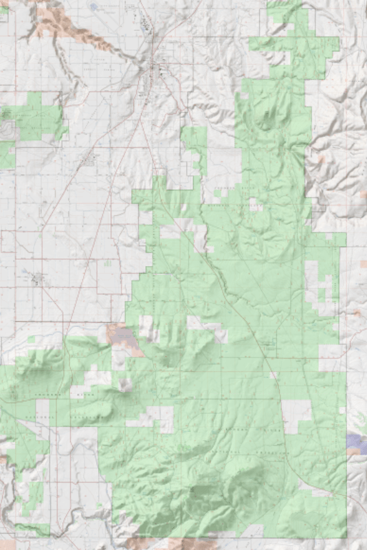
The Crooked River National Grassland is located north of Redmond, West of Prineville and South of Madras, OR in a triangle whose boundaries are primarily made up of US Highway 97, US Highway 26 and Smith Rock State park. It is approximately 174000 acres and contains two National Wild and Scenic Rivers, the Deschutes River and the Crooked River. The grassland is managed together with the Ochoco National Forest by the USDA Forest Service office in Prineville, OR.
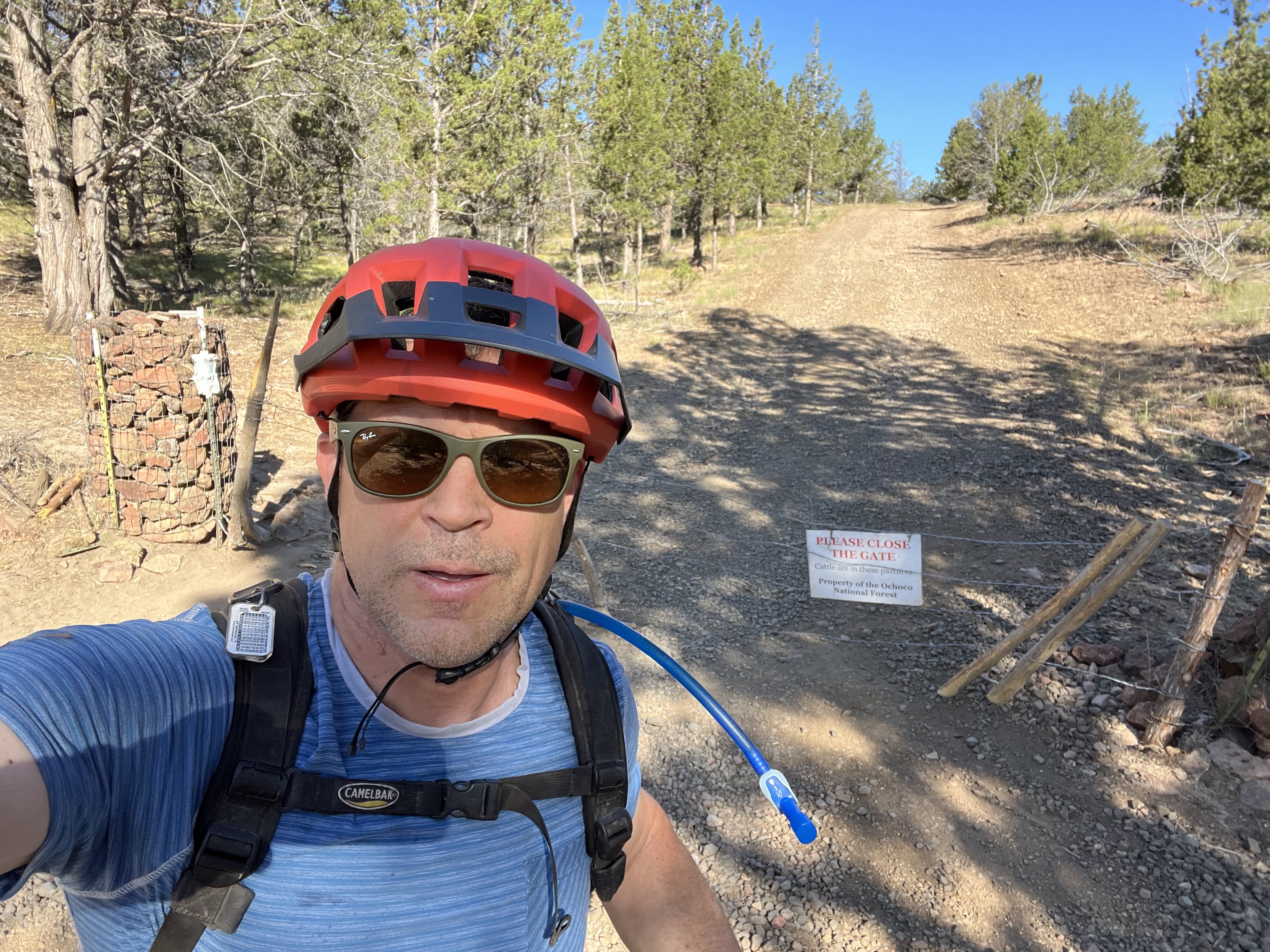
Most of this ride was on the Cole Loop Trail #100, a 25 mile equestrian route that has been adopted by mountain bikers and hikers. Since it was developed and is maintained by the equestrians, they have the right of way. Several year back, the Forest Service built a very nice trail head just across Skull Hollow Rd from the Skull Hollow Campground, a popular spot for visitors/climbers to Smith Rock due to its proximity to the park. While the state park has some walk-in tent camping, this campground has space for vans/campers/rvs and pit toilets. Additionally, there are numerous disperse camping spots along Skull Hollow Rd. up to and including several spots at the junction of Cole Loop/Grey Butte and the Grey Butte access road.
The first mile of the trail parallels Skull Hollow Rd. then one can choose to continue on the the single track or join the fairly well maintained dirt/gravel Grey butte access road, which was what I did. The lower section of the single track that used to be know as Skull Hollow Trail took quite a bit of flood damage this past spring and is know to be a fun and fast downhill, so during spring/fall riding seasons you are likely to have to get off the trail for riders descending.
The access road climb is approximately 1.25 miles to the saddle where the route joins up with the Cole Loop/Grey Butte trail. This is where the ride gets tough, the next 3/4 mile is a very steep, rocky, loose switchback section. I ended up hike-a-biking a fair amount of these corners to conserve my energy for the remainder of the ride. At about 3.25 mile from the start, the climb tops out with spectacular views of the Northern section of the grassland.
There is a short descent to a gate where the Grey butte trail heads north and Cole Loop heads downhill to the west. This descent is in much better shape than the climb, with a better trail bed and much less rocky.
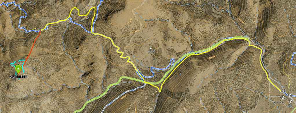
It was just under 1 mile from this point to an old jeep 2-track that leads part way to the summit. I followed the track up a couple hundred yards to a point where the junipers stop and the track got too steep to ride and ditched my bike. From here I thought it was only a 1/4 mile to the summit but what I was looking at was a false summit, which was also a band of lava rock that forced me to work my way around to a ridge to the North east. The 2-track steepens and becomes a rain rut, then ends at a nice flat spot with shade. I rested for a moment in the shade before traversing to the East to pickup the ridge.
I hit an old fence line and followed it up to the rocks, at which point I pulled out SOTA Goat and realized I was still a 1/4 to the true summit. While I was in the AZ, I decided to push on up, following the top ridge across a large open area and up to a stack of lava marked with a stick that is the true summit. Fortunately, there is plenty of shade created but numerous juniper trees as it was getting warm already.
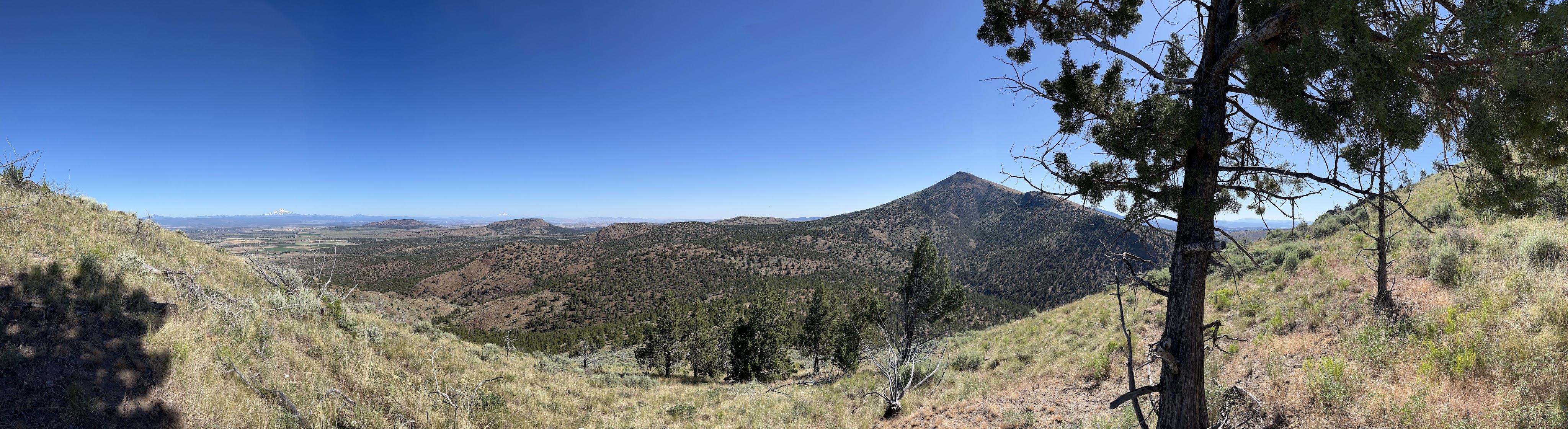
The 360 degree views at the summit are fantastic. This is one of the best things about the Crooked River Grasslands summits is that on a clear day you can see South to Newberry Crater and North to Mt Hood with the breadth of the Central Oregon Cascades in between.
After a quick snack I pulled out my 2M HT and roll up J-pole, and called CQ on 146.58. I got a quick response from KD6PLU, my top chaser based in Bend, then proceeded to get 2 S2S from peaks near Eugene, OR. They were working a number of other stations I couldn’t hear so after a few minutes I decided to setup the HF rig and do some CW on 40 and 20 meters.
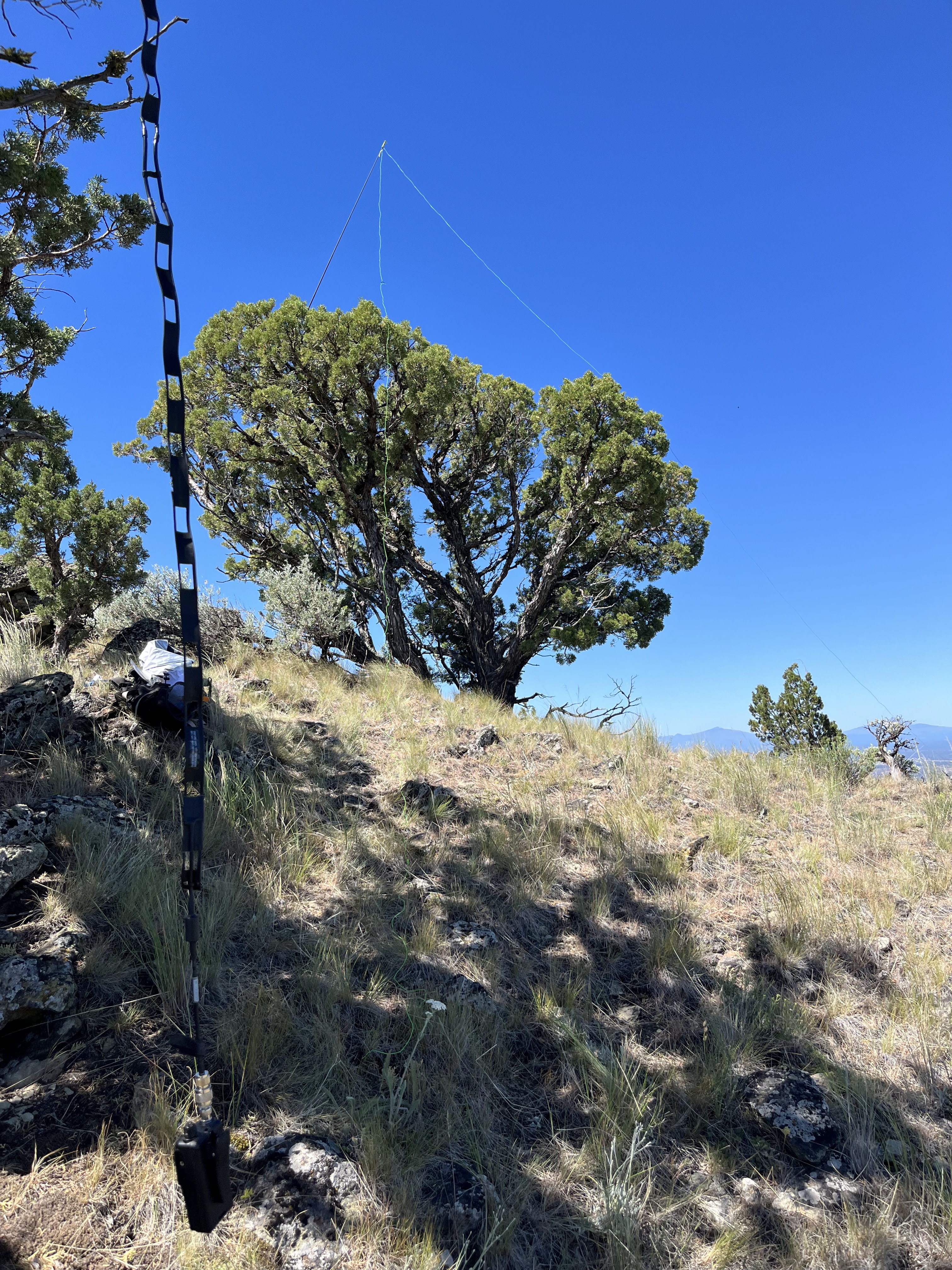
HT on the roll up J-pole in foreground, HF EFHW In the back.
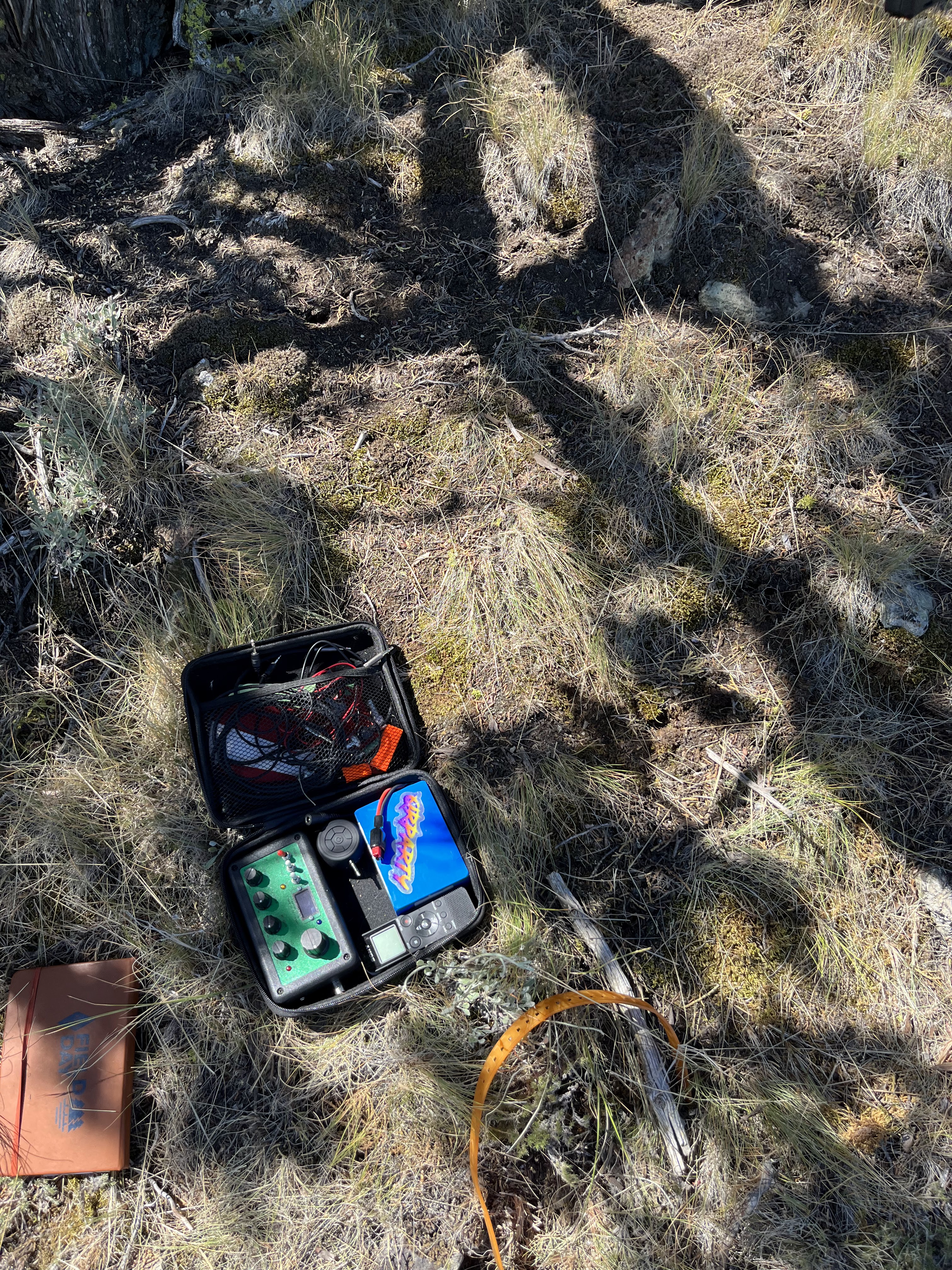
Penntek TR-35 Kit
My cw is suffering the lack of practice and combined with QSB, I struggled a bit but was able to get 8 contacts on 40 and 6 on 20 in the hour I operated. My longest contact was a station in NY, which I was surprised by on 20M.
The day was predicted to hit the lower 90’s and I wanted to be down by noon so I packed up and headed back down after a little over an hour on the summit. The walk down was uneventful, though one should take careful steps as it is pretty steep and loose, trekking poles would have been a nice thing to have.
Back at my Salsa Horse thief, I made quick work of the mile climb back to the saddle gate and down the Cole Loop Trail back to BGNOUT. The total distance just about 10.5 miles RT.
W7O/CE-300, aka 4420, is located in the Crooked River National Grassland just north of Smith Rock State Park. It is a moderate hike but due to the difficult access, I would qualify this as a intermediate SOTA. It could be approached via foot, off-road vehicle/motorcycle, 4×4 horse or bicycle. The hike up once off trail is off-camber but is very navigable. I would suggest trekking poles for help with footing. Once on the summit ridge, its an easy hike to the top. I rode my mountain bike and it took me about an hour and fifteen minutes to get to the top from the Skull Hollow trail head. I would think it would be closer to 2 hours on foot. I saw evidence of UTV / motorcycle usage up to the point where I dropped my bike, but I haven’t any idea how long that would take. Great views and plenty of operating positions are available in the ample AZ. 2M was hopping with activators in the Willamette Valley and Northern Cascades on the Saturday morning I was there so one could easily activate without HF with planning.

Leave a comment