Every day is Field Day when you’re a SOTA Op, but once again this year, KK7HJL and our SOTA pack wanted to get out and do a hike/activation. It also being our wedding anniversary, we decided to take BGNOUT south to the Fremont National Forest, a small but gorgeous forest in South Central Oregon. We really wanted to celebrate by having dinner at the infamous Cowboy Dinner Tree, unfortunately they were completely booked until later in July. I’d highly encourage anyone planning to visit the area to make a reservation and experience the off-grid restaurant.
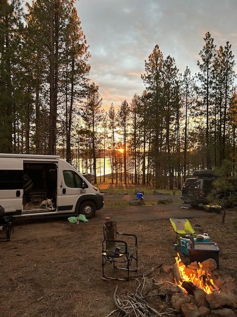
There aren’t many campgrounds in the Fremont-Winema NF, but there are plentiful established dry camps with fire rings and some with picnic tables. Tim, N7KOM, and his SOTA pup Lance and I drove down early on a Friday to see if we could secure a spot at the ‘First come, first serve’ East Bay Campground at Thompson Reservoir. We were able to grab one of the last available spots, though it didn’t have a table, just a fire ring. Since we always have an extra table in BGNOUT, we decided to take site 15 rather than site 14, which had a table but not fire ring. The Fremont-Winema NF is relatively remote and one of the least funded forests in Oregon, so it seems like recreation support budget is pretty tight. This is exemplified by the state of the facilities around the campground so be prepared. There was toilet paper, but I wouldn’t plan on it.
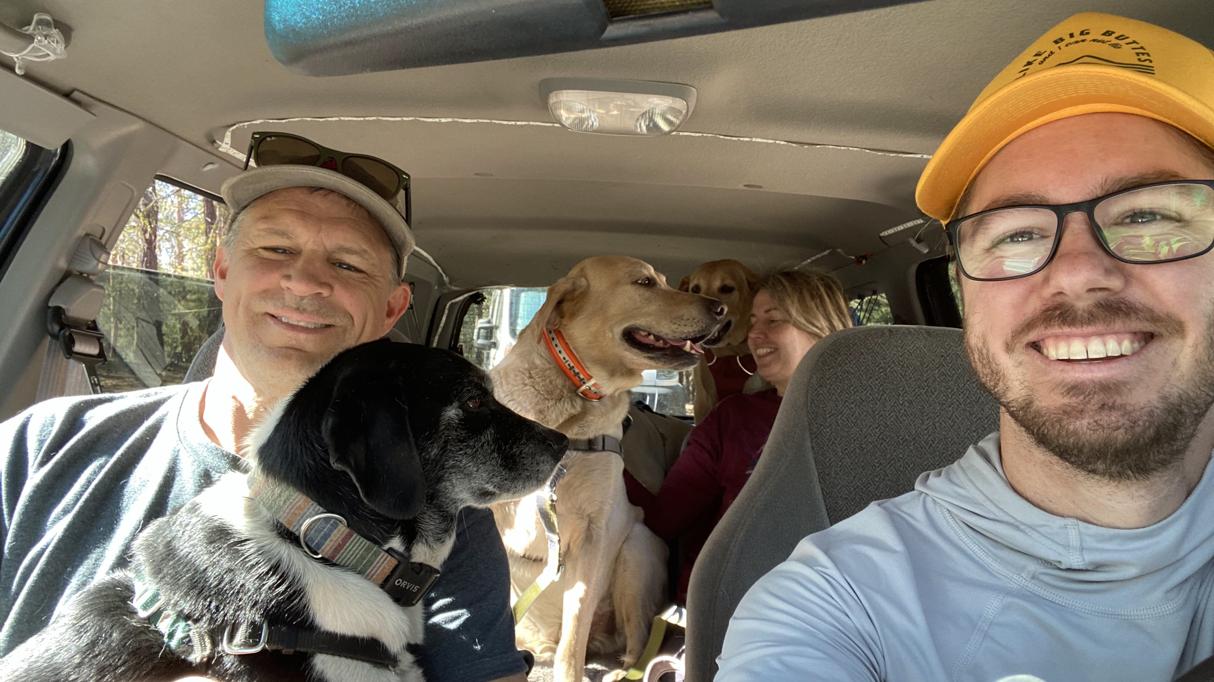
Hager Mountain has an active Fire Lookout that is manned from May-October. It is available to rent during winter months for those intrepid enough to hike up the road (I doubt the trail is passable in snow). The hike can be started from several spots, depending on how long you want to walk. There is a trailhead where the trail crosses NF28, the primary Eastern paved route, or via NF28-0012, a fairly well travelled, red cider double track. We decided to pile in Tim’s Ford Explorer and drive up to the furtherest access on the double track to shorten the walk for the 4 dogs.
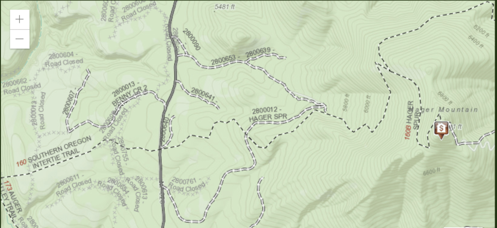
The 2.25 mile hike gains 1350 ft. The trail is very well established with plenty of blue diamond, plastic blaze signs along the route. We didn’t see anyone on the way up but did encounter a couple of groups on our way down, along with a pack of horses traveling from a nearby horse camp. Bring bug spray or netting, the mosquitos were THICK!

Upon reaching the summit, we were surprised to see a family flying a kite next to a tent and a truck. I remembered reading that the road was gated to prevent the public from driving up during fire season. The woman who was stationed at the lookout had her sister and family staying for the weekend, but let us come up and play some radio from near the cab. Tim setup his old 35W Mobile and Yagi on a tripod and we attempted calling CQ on 2M without much luck. Surprisingly he did get a long distance response from Washougal, WA but the other operator wasn’t interested in working all three of us. Thankfully, Scott, KC7JWM, happened to be driving to meet a party at the Cowboy Dinner Tree and was monitoring 146.52, so we all get him in the log.
After about 40 mins we decided to move down to the picnic table that we saw on our way up to the cab. It was out of the way of the family flying the kite and there was plenty of space to setup the Yagi, a 10M Dipole and a long wire for lower bands, though there was no shade for humans, doggos found shade under the table… mostly.

Picnic Table with bad mannered labrador
While I worked on setting up the 10M for KK7HJL, Tim setup his KX2 with an EFHW on 20M and began calling CQ. Propagation was not great but just when I was about ready to take over, a group of equestrians arrived on scene creating havoc with the dogs. Hank, our recently adopted rescue dog, started barking and howling and the rest of the pack chimed in. The horses were a bit spooked with the dogs and the wires in the air. It took a few minutes to settle everyone and get the horses past. I took over the key on 40M and made 3 S2S QSO’s before the band went dead again. Tim took over and made a couple more contacts but overall it was a very rough day on HF.
After about 2 hours on summit we packed up and made our way down to the truck. It took about 45 minutes to descend the 2.25 miles and a few more to pack the tired dogs and humans. I forgot to take any pictures but did remember to get some of the road conditions on the way down. It is in relatively good shape, a couple of loose sections of rock but passable by a car. We were worried about the clearance of the van so choose not to drive it up, however after seeing the road, we would have had no problems.
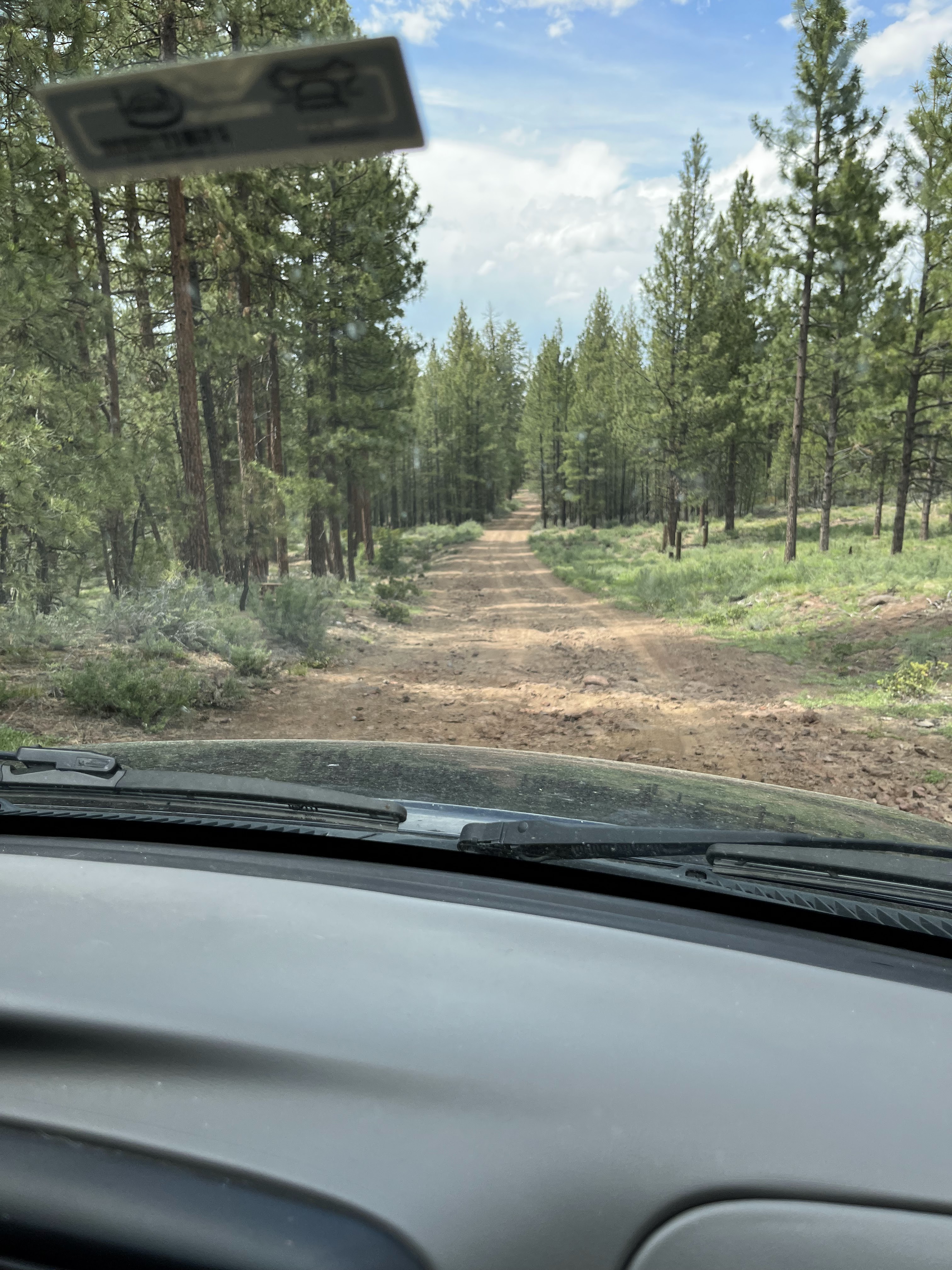
Forest Road 28-00012
Hager Mountain, W7O/CE-028 is a moderate to hard hike depending on the length you choose. It can be done as either an 7.5,6 or 4.5 mile RT depending on where you park. Parking at the trailhead on FS RD 28 is the easiest access with longest hike, but if time or energy is a concern driving up the 28-000012 road a couple of miles is worth it. Bring plenty of bug spray and extra water… also some kind of shade if you have it, summit is pretty exposed. There is a picnic table, vault toilet and the fire lookout on summit. Just to the east of the picnic table there is a rock extrusion that would make an excellent, out of the way operating spot. 2M is pretty rough out there, so I would plan on operating HF primarily.

Leave a comment