Tag: QRP
-
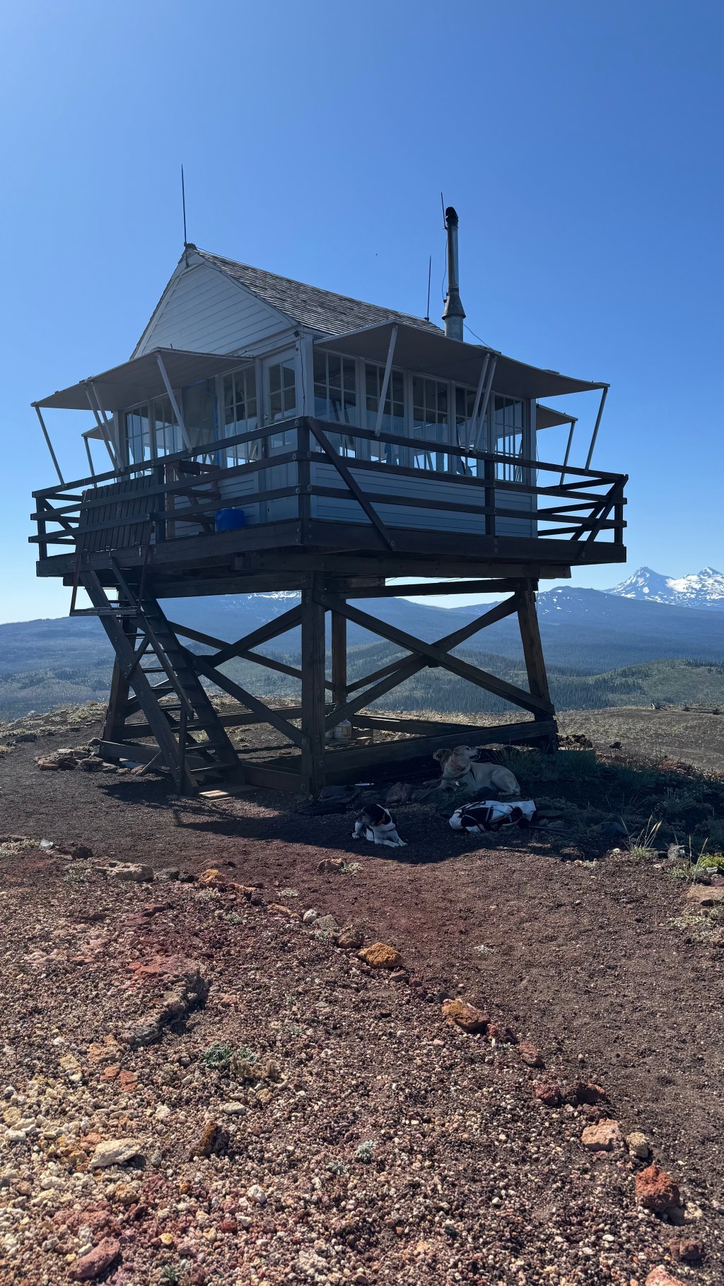
Cultus Mountain W7O/CM-036 | August 2025
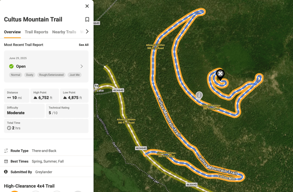
While researching our Brown’s Mountain outing, I discovered several recent trail report indicating that the road up to the top of Cultus Mountain had been cleared of trees and was passable for the first time in many years. The morning was spent on Brown’s and after some lunch and a beverage at Cultus Resort (which…
-
Brown’s Mountain W7O/CM-085 | August 2025
Brown’s Mountain is near the Crane Prairie Reservoir. It had only been activated one other time by K7ATN and K7FOP back in 2019. They approached the summit from the East side via the Brown’s Mountain Loop Road. The report they published describes a very uninspiring experience. However, in researching alternative routed, Tim N7KOM, found a…
-
Shukash Butte First Activation | August 2025
In preparation for the 2026 W7O Campout to be hosted at Crane Prairie Campground next to Crane Prairie Reservoir in Central Oregon, N7KOM, N7OLE, N7KOM’s YL and myself decided to scout this unactivated summit. It being the closest summit to the campground it makes sense that many operators would be interested in getting some intelligence…
-
Willow Butte

Activation Report | July 2025 | W7O/CE-103 Willow Butte [W7O/CE-103] is an easy 4 pointer located in the Deschutes National Forest just 20 Miles SE of LaPine, OR. From Lapine take FS22 21 miles to NFD 2400-900. Turn south for ~ 1mile to NFD 2400-930 on the right. NFD 930 is soft and rutted but…
-
Sand Mountain
Activation Report – July 2025 – W7O/CM-077 Sand Mountain is located on the Cascade Crest in the Willamette National Forest. It can be access from the Big Lake Recreation Area with a reasonably high clearance vehicle via the Old Santiam Wagon Road, FSR 2690-810. The route was used for hauling freight over the Cascades between…
-
Activation Report: W7A/NM-131 | Fortification Hill
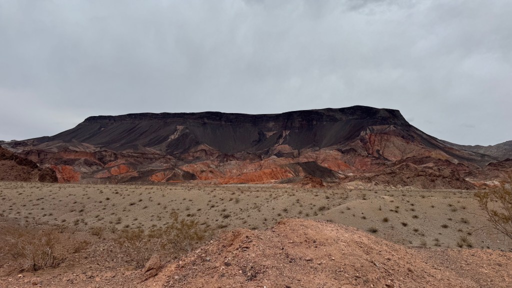
N7OLE and I had to fly down to the area to attend a Memorial Service for Randi’s uncle and now SK Marvin, KL1YY. After flying into Las Vegas and renting a car, we drove to Boulder City for a night in the Historic Boulder City Dam Hotel. We packed light for the cheap flight but…
-
Activation Report: Maury Mountains 5 Summits | W7O/CE-081, W7O/CE-084, W7O/CE-101, W7O/CE-265, W7O/CE-274
The Maury Mountains are a mountain range in Crook County, OR. Much of the range is within the Ochoco National Forest. Located Approximately 50 miles East of Bend, OR. There are 5 SOTA Summits within the bounds of the Maury, 3 6 pointers and 2 4 pointers. All 5 are nearly, if not complete drive ups, making it possible…
-
Activation Report: W7O/CE-278
This summit, 5580, is located in the Ochoco National Forest approximately 30 miles east of Prineville, OR. It has been activated regularly since 2018 as it was easily accessible via an old logging track. Sometime in the relatively recent past the forest service closed the logging road, requiring a less direct approach via FS 300.…
-
First Activation: W7O/SE-028 | Riddle Mountain, OR | May 2024
This is the second, first activation of the day as Randi – N7OLE and I rode our Kawasaki dual sport motorcycles during the 13th Annual Giant Loop ride the weekend of May 29-June 1, 2024. The day started on Stinkingwater Pass with the first activation of W7o/SE-051, Crowcamp Mountain. After finishing our delicious hamburgers at…
-
First Activation: W7O/SE-051 | Crowcamp Mountain, OR
N7OLE and I attended the Giant Loop Ride at Crystal Crane Hot Spring near Crane, OR at the end of May, 2024. Being a fairly unpopulated part of the state, there are ample opportunities to grab some first activations so we took advantage. As it turned out, one of the routes that is suggested by…
