-
Trip Report: 7 Summits in the Dolomites of Northern Italy – I/VE
N7OLE wanted me to plan an international trip for her birthday. We looked at several options including Norway, Scotland and Switzerland but ultimately settled on the Italian Dolomites. The original idea was to do a hut to hut hiking trip but after some investigation I decided it would be less stressful to base ourselves from…
-
4th Annual Central Oregon S2S Party
Date: September 27, 2025 Location: Ochoco National Forest east of Prineville, OR QRV: 11:00AM PDT Frequency: 146.58 primary / 146.56 backup It’s time for another fun day of Summits on the Air in Central Oregon! We are currently planning on activating summits in the Ochoco National Forest East of Prineville. There are a variety of…
-
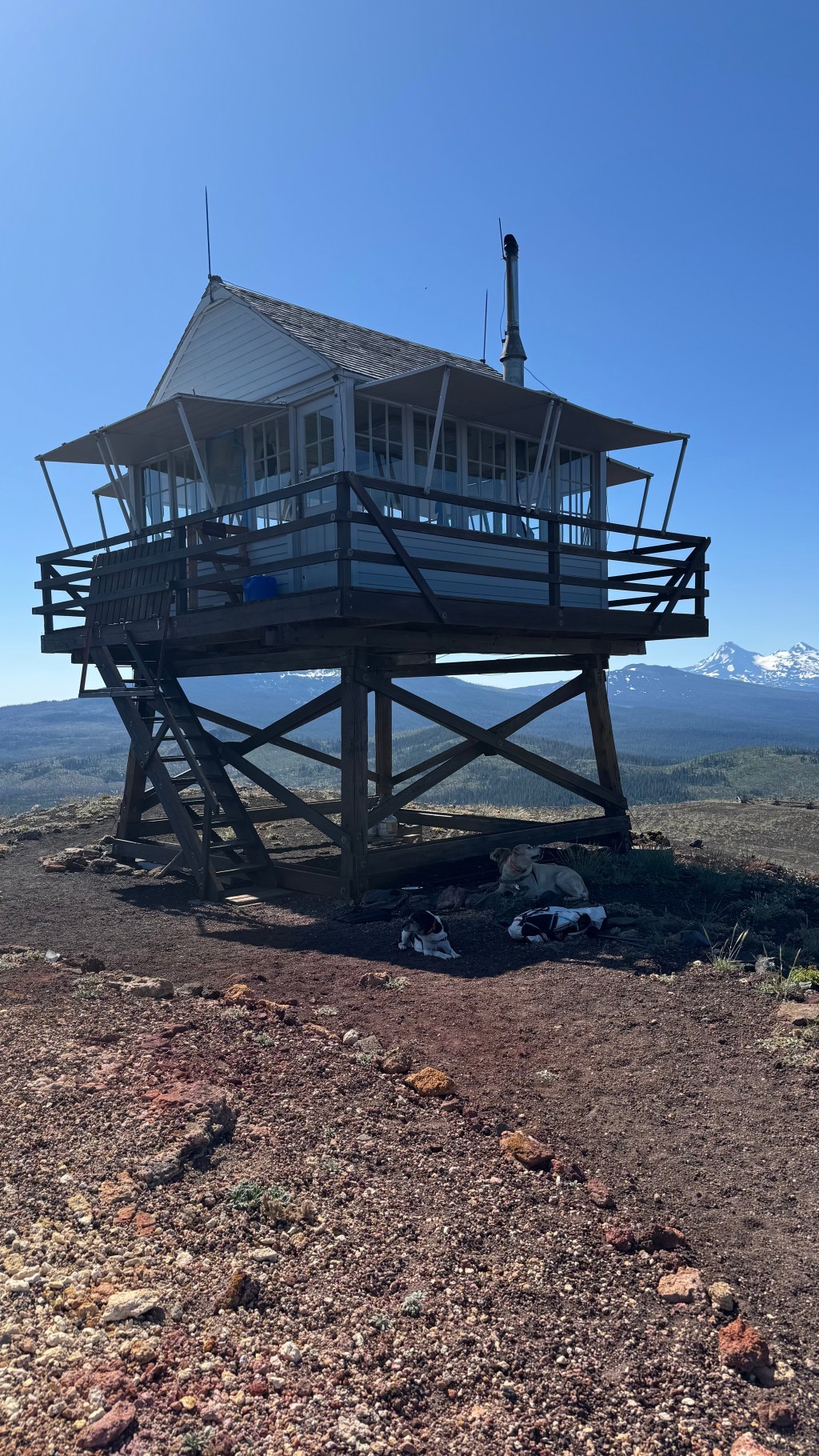
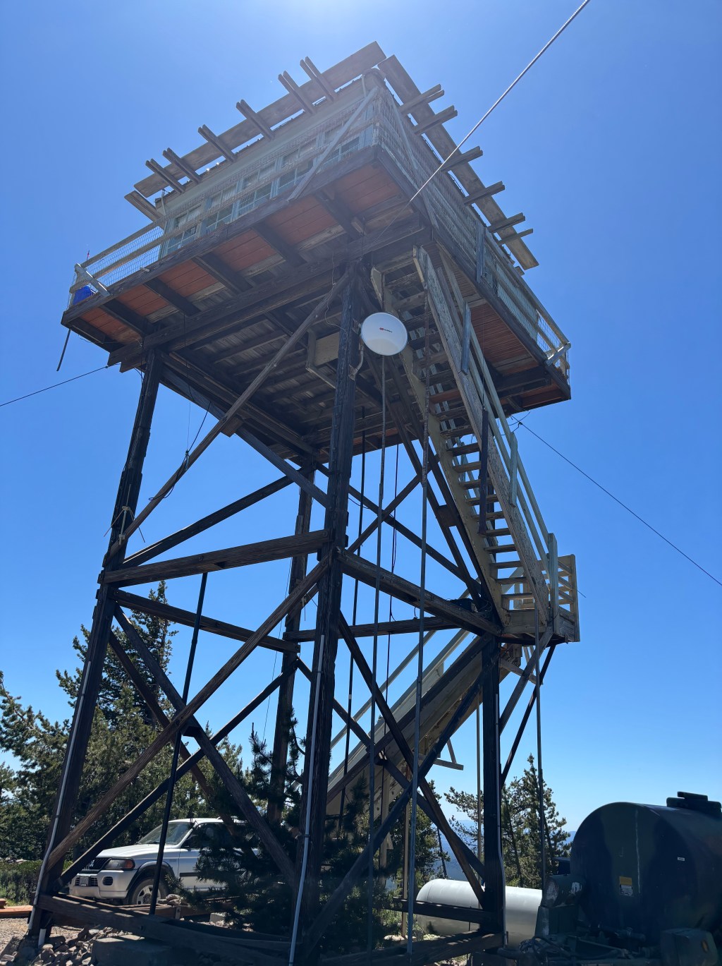
Cultus Mountain W7O/CM-036 | August 2025
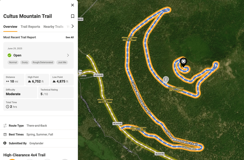
While researching our Brown’s Mountain outing, I discovered several recent trail report indicating that the road up to the top of Cultus Mountain had been cleared of trees and was passable for the first time in many years. The morning was spent on Brown’s and after some lunch and a beverage at Cultus Resort (which…
-
Brown’s Mountain W7O/CM-085 | August 2025
Brown’s Mountain is near the Crane Prairie Reservoir. It had only been activated one other time by K7ATN and K7FOP back in 2019. They approached the summit from the East side via the Brown’s Mountain Loop Road. The report they published describes a very uninspiring experience. However, in researching alternative routed, Tim N7KOM, found a…
-
Shukash Butte First Activation | August 2025
In preparation for the 2026 W7O Campout to be hosted at Crane Prairie Campground next to Crane Prairie Reservoir in Central Oregon, N7KOM, N7OLE, N7KOM’s YL and myself decided to scout this unactivated summit. It being the closest summit to the campground it makes sense that many operators would be interested in getting some intelligence…
-
Willow Butte

Activation Report | July 2025 | W7O/CE-103 Willow Butte [W7O/CE-103] is an easy 4 pointer located in the Deschutes National Forest just 20 Miles SE of LaPine, OR. From Lapine take FS22 21 miles to NFD 2400-900. Turn south for ~ 1mile to NFD 2400-930 on the right. NFD 930 is soft and rutted but…
-
Sand Mountain
Activation Report – July 2025 – W7O/CM-077 Sand Mountain is located on the Cascade Crest in the Willamette National Forest. It can be access from the Big Lake Recreation Area with a reasonably high clearance vehicle via the Old Santiam Wagon Road, FSR 2690-810. The route was used for hauling freight over the Cascades between…
-
Activation Report: W7O/CE-020 – Bald Mountain
Bald Mountain is located in the Fremont-Winema National Forest in Central Oregon. Located approximately 30 miles south of LaPine, OR. From Lapine head South on US97 to Highway 31. After 13 miles turn south on USFS 2516, a well maintained Forest Service road. Head South for another 13 miles to NFD277. There is an active…
-
Activation Report: Morgan Butte [W7O/CE-025]
![Activation Report: Morgan Butte [W7O/CE-025]](https://w7mtb.blog/wp-content/uploads/2025/06/img_1973.jpg?w=1024)
Morgan Butte is a drive near, located approximately 15 mile South of Paisley, OR in the Fremont-Winema National Forest. It is topped with a fire lookout cab and a vault toilet. The route is partially paved, but the last 7 or so miles is on well maintained forest service roads that traverse an area burned…
-
Activation Report: Spring Butte [ W7O/CE-154] and Green Butte [W7O/CE-117]
![Activation Report: Spring Butte [ W7O/CE-154] and Green Butte [W7O/CE-117]](https://w7mtb.blog/wp-content/uploads/2025/05/20250504_122800.jpg?w=1024)
Spring and Green Buttes are 4 pointer drive ups in Southern Deschutes County, OR. Both are accessed via Forest Road 22 in LaPine, OR, a nicely paved forest road. At about 10 miles, we turned South on NFDR2220 towards Spring Butte. At 6 miles there is a short right then left juke on NFDR2430 and…
W7MTB: Amateur Radio Notes
Notes on operating Summits on the Air
