Black Butte is an extinct stratovolcano in the U.S. state of Oregon. Located in Jefferson County, it is part of Deschutes National Forest. Black Butte forms part of the Cascade volcanic arc. The butte lies just south of the Metolius Springs, which merge to form the headwaters of the Metolius River. The Metolius River’s basin sustains a wide array of plant life, large and small mammals, and more than 80 bird species.*
It became an icon of the area after the Deschutes Brewery named one of their flagship beers after the prominence. Black Butte Porter is a delicious English style dark porter developed by Gary Fish back in 1988 as one of the first beers produced by Deschutes and is still the nations #1 selling Porter.
Black Butte also happens to be one of the 8 Central Oregon buttes that are part of the annual Big Butte Challenge put on by the Cascade Relays organization. This is the second year Randi, KK7HJL, and myself have participated. It turns out that four of the buttes are also SOTA Summits so we get to kill 2 birds with one stone. For each summit one completes, a beer token is awarded for the sponsoring local brewery, a nice incentive to stop by for a beverage and some after hike food.
I got a late start this year on the challenge, but still have plenty of time to complete the remaining 7 summits. Last year KK7HJL and I did Black Butte for field day. It was during that activation that she decided she needed to get licensed so she could have some fun on the air instead of standing around waiting for me. This year we recruited Tim N7KOM and XYL Devan to do the challenge along with us.
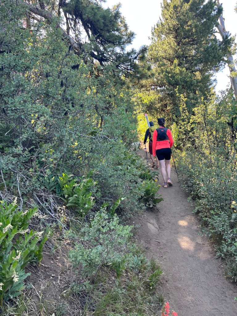
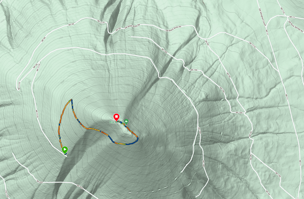
The Black Butte trailhead is notoriously busy during the summer tourism months. We saw dozens of people on the hike up. The hike is a moderate challenge, the biggest concern in July is heat and hydration. We got a bit of a later start but it was still very pleasant when we reached the summit at 11:15AM after a 60 minute walk up the 2.1 mile hike from the parking area. The first mile is in the trees and shaded but be prepared for full exposure once the trail traverses into and old burn area for the remainder of the walk. There are a few patches of shade but not many.
Tim -N7KOM’s K6ARK End Fed Random Wire deployment.
Once on top, N7KOM found a nice shady spot to setup the Elecraft KX2 and EFRW. I having several times in the past couple of months carried my IC-705 and not used it, was determined to setup my on station. I brought along the Chameleon MPAS lite 17″ vertical. I bought the Chameleon Delta Loop last year during the Black Friday sales and have used it in the field for POTA activations a couple of times. The delta loop kit includes all of the same parts that the MPAS lite kit comes in addition to the extras required to make the delta loop, so I decided to try it out in the field.
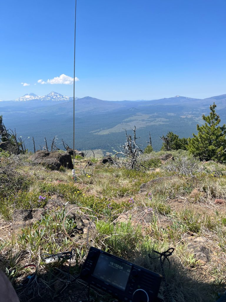
The week prior I was testing the SWR with various counter poise lengths. I was able to achieve sub 1.2 SWR on all of the higher bands, 10-20M but had some trouble with 40M. During my testing I was able to get it down to around 1.5 but couldn’t achieve the same results on 40 in the field. SWR was pegging the meter on the IC-705 even with a full 33+ feet of counterpoise. After my 3rd attempt at manual tuning (extending/retracting the counterpoise) I decided to just try making an S2S contact with and activator in Idaho. It took a lot of work and he ended up giving me a 229, which made sense since it was pegging over 3.0 SWR.
Regardless of my bad luck on 40, I was able to pickup F4WBN on 10W 17M SSB, which was a surprise. Christian is notorious for giving everyone a 599 on CW, so I was happy to get a 559 on SSB. I picked up another, K6HPX from AZ but then SSB dried up and I switched to CW. There was a lot of action right away, and I picked up another 5 on 17M CW but struggled with the last call for too long and my chasers lost interest. WB6BHN turned out to be a difficult one for me to copy. After a few minutes of calling CQ, I switched over to 14M SSB. That turned out to be a bust so I went on to CW. I had only a bit more luck there, with all of 1 CW S2S… rough day.
It was just about then I got a text message from Tim that Devan was ready to go, turns out that I missed the text because I was already tearing down. The sun was getting high and the wind picking up and I was getting hungry. We ran down the trail to the shade because Lance’s (the sota dog) paws were getting burned by the decomposed lava. Once in the shade we slowed to a walk but were back at the car in short order.
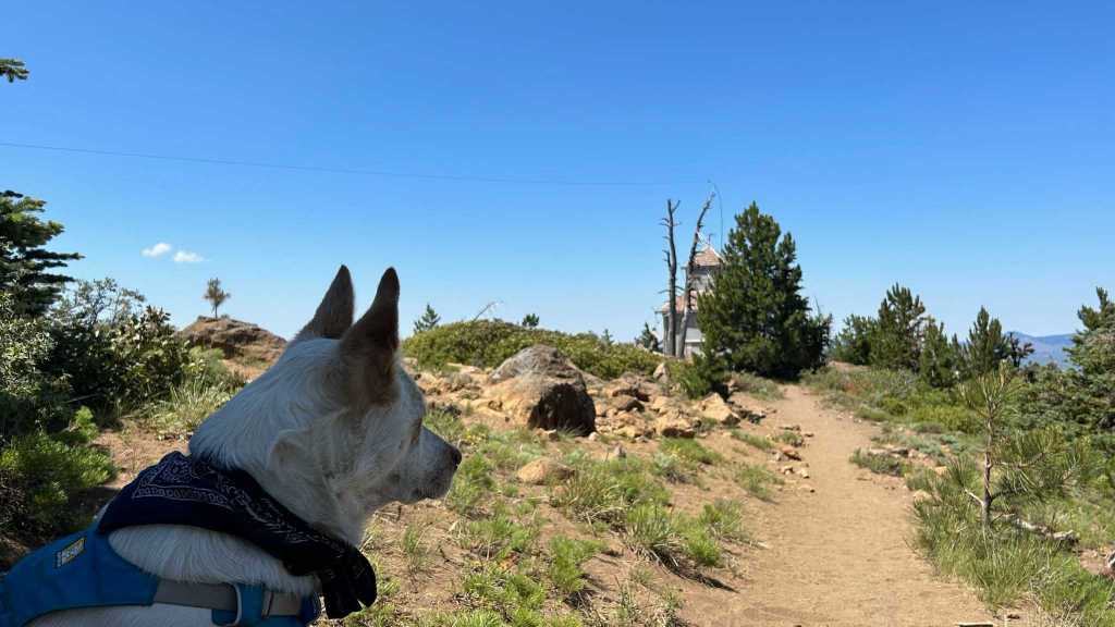
Lance surveying Mt. Jefferson
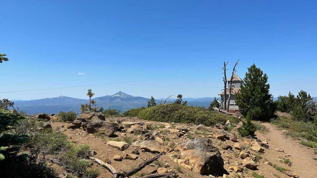
Black Butte is a moderate hike, with phenomenal views of the Central Oregon Cascade range. There is an active fire tower that should be avoided, as the public is not allowed near the tower during fire season. The hike is a 2.1 mile, steady pitch that ascends 1600ft from the parking area. Getting to the trailhead can be done in any passenger car, though the last mile is a bit rough due to a lot of runoff from the heavy snows this past winter. From US Highway 20 turn South on FS-11, then take a left on FS-1110 to the parking area. The route is signed well but the lower section of FS-1110 is gravel and very water boarded so take it easy and plan extra time. Bring extra water, sunscreen and a layer in case the winds pickup or a mountain thunderstorm develops spontaneously. 2M can work if you are patient but its not a bad idea to bring an HF capable radio as well as Central Oregon can be a quiet zone at times.

Leave a comment