I have a goal of activating all the summits in the Crooked River National Grassland before the end of 2023. The journey started back in January with Juniper Butte [W7O/CE-223] on the Western edge of the Grassland. In March, Tim-N7KOM and I hit Gray Butte [W7O/CE-180] and Sister’s View [W7O/CE-303] on a blustery spring day where we saw sun, rain, sleet/hail, snow and more sun. Then in July, I decided to get out and tackle the no-name, W7O/CE-300, a rarely activated gem to the SE of Gray Butte. With that one done, I had only to tag on Haystack Butte [W7O/CE-221] and Pine Ridge. Haystack Butte will be the last after today’s successful outing with N7OLE to knock out Pine Ridge.
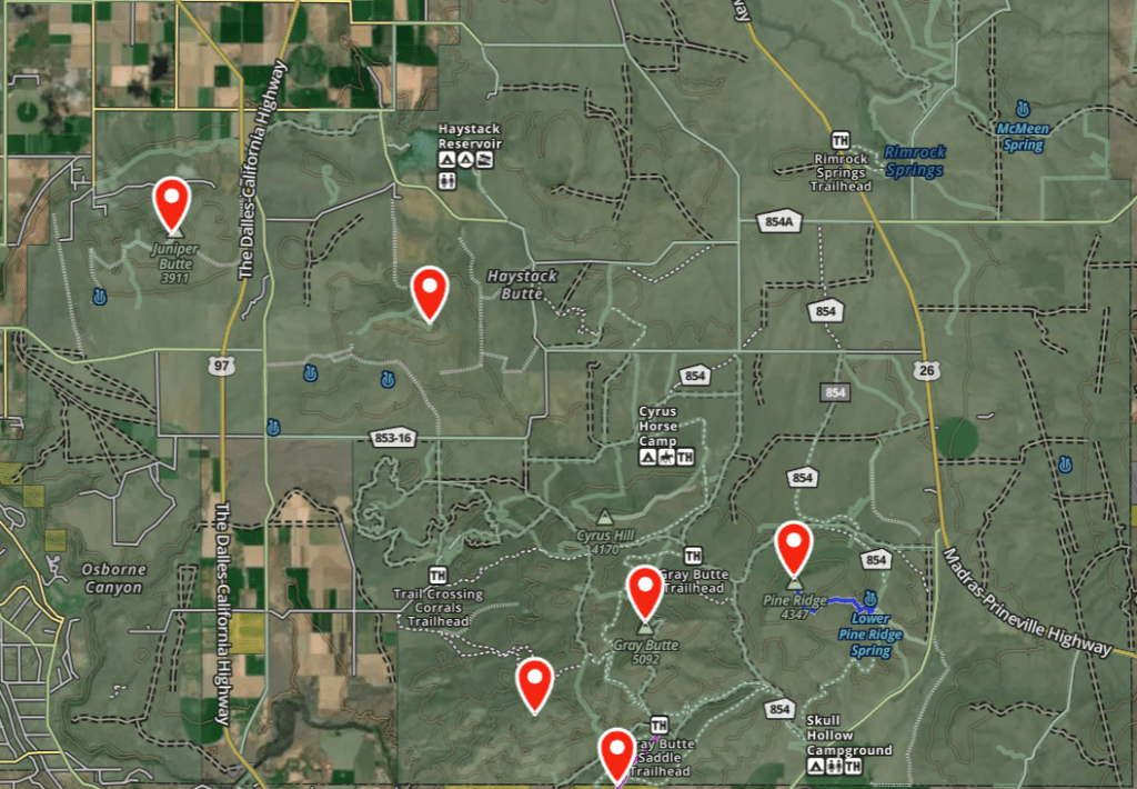
The only report on Pine Ridge I found was on the PNW Sota Website from K7ATN from a few years ago. His approach looked to come in from the N/NW and I found what seemed like a shallower hike from the East, assuming we were able to drive our truck on a double track road as it appeared on the maps.
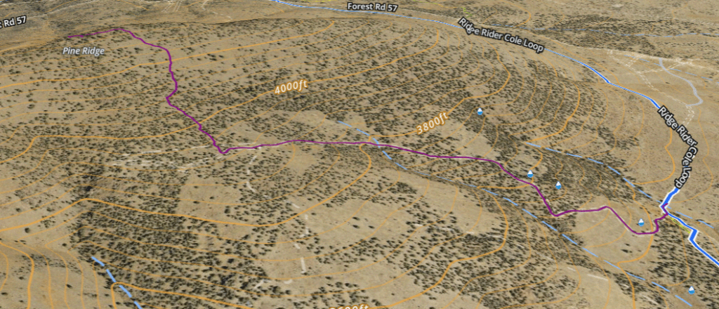
Turning West off of Lone Pine Rd onto Forest Rd 57, we drove approximately 0.6 mile and turned left onto FS 5700-100. We headed South for another approximately 0.7 mile until we reached a small draw, with a cow pen where the road turned down hill to the east. We found a place to park the truck off the road and began the climb up a double track trail on foot. We had to open and close the barbed wire, cow fence gate and wade through 20-30 Herefords who didn’t want anything to do with us. The 2 track isn’t terribly rough, and I am sure a passenger car with all wheel drive could easily make it up, the only difficulty would be the steepness. Certainly a high clearance 4×4 would make easy work of the trail. The road was actually quite smooth for a high desert double track.
About half way up we did get a surprising glimpse of a rattlesnake crossing the road. It had probably been lying there in the sun until we rudely interrupted its nap. We commented that we were glad we left the doggo pack at home for this one, they would certainly have made a ruckus about the snake.
After about 0.8 mile we sighted a clear path to the ridge and headed off track, up to join the ridge line. The going was fairly easy, even though the terrain steepens here, the ground was solid from our recent rain storms and there isn’t much vegetation to stumble over.
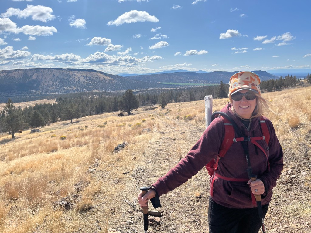
We climbed another 0.5-0.6 miles to the ridge then made our way to the true high point of the ridge. Sota Goat showed us within the AZ as soon as we crested the ridge but I was determined to stand on the highest point. The wind was blowing from the North so after the high point photo op we found a nice wind protected knoll from which to operate.
N7OLE but together her 2M Arrow Yagi while I setup for 40M HF with the IC-705 and K6ARK Linked EFHW. We made 2 quick 2M contacts with a couple of guys who were packing up from doing a POTA activation of the Grasslands just below us, then I put in the earphones and began calling CQ on CW. We were both able to activate and get the 2 points within a relatively short period, though I spend some more time on both 40M CW/SSB and 20M CW/SSB. After about 50 minutes of operating we packed up and headed back down to the truck and back into Redmond for some food and a beverage at Wild Ride Brewing.
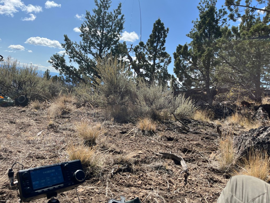
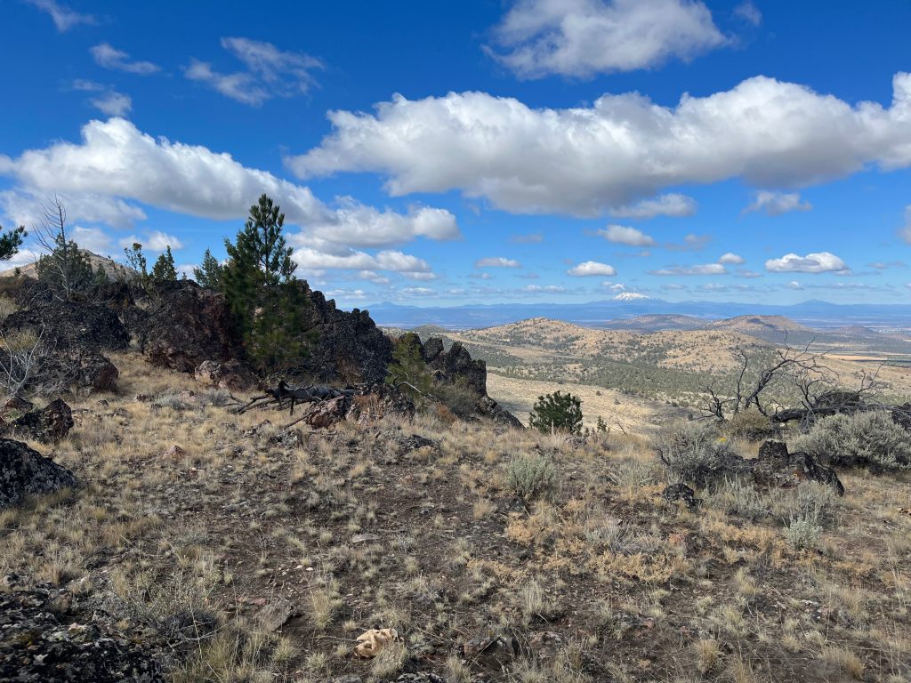
Pine Ridge is an easy to moderate hike along a double track and easy bush wacking. Any passenger car should be able to navigate to the place we parked and many would likely have no trouble driving further up the 2 track if desired. We had plenty of activity on 2M and I wouldn’t expect any trouble activating 2M only. The views of the Grasslands and Central Oregon Cascades are fantastic and the solitude is remarkable for the ease of access.

Leave a comment