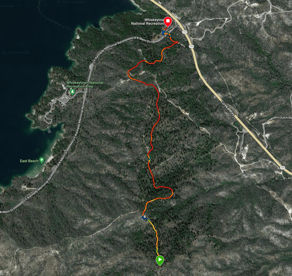
After a long and tiring weekend of offroad motorcycle training SE of Sacramento, I decided to overnight at Whiskeytown NRA just west of Redding, CA. I like the Peltier Bridge Campground down by the river. Its a dry/tent only campground, though we have stayed there in BGNOUT a couple of other times in the past. I had initially planned to activate Mule Mountain, W6/NW-386 by mountain bike but was feeling too tired to get the bike out after 3 days of hard training on a big adventure motorcycle and opted for a fairly easy hike instead.
The trail up is really just a fire road, and a pretty well maintained one at that, though it is not referenced as a hiking trail on any of the official maps, OnX Backcountry shows the route as the Shasta Divide Trail. I asked a NPS employee who was cleaning the bathrooms and she knew of the trail but couldn’t say if it was open so I just went for it.
The trailhead is just across the road from the visitor center parking area, which has plenty of shade and flush toilets so I parked BGNOUT, locked the motorcycle to the trailer, collected my pack and started up. It was unseasonably chilly with a brisk NE wind blowing which made the hike up pretty pleasant.
The first 100 yards is single track trail that exits onto the very obvious, crushed granite road. The ascent takes one up to a false summit where the high tension power lines from the hydro electric generation station at the base of Whiskeytown Lake pass over. The remainder of the climb is on the road, except the last 100 yards which follows what looks to be an old road track that has been covered with cut trees to prevent future use. The summit is bare with plenty of views and several live oak trees to toss a rope into. Not much in the way of a place to setup a mast without guy lines.
I setup and called CQ on 2M, 146.58, but got nothing, so I switched over to .52 and got a couple locals (though the second wasn’t too happy about me using .52 for “contesting”). After that I decided I should just do HF. I setup my newly constructed K6ARK EFHW linked dipole connected via the K6ARA SWR meter into the Penntek TR-35. I started calling CQ on 14.061 and after spotting started getting responses. QSB was rough so after about 7 contacts I switched to 40 M and got another 7 or so. Having not activated in a few months, my CW copy was a struggle and I had some trouble with the K6ARK paddles I was using getting stuck and sending strings of dits or dahs but eventually got it done. Packing up after about an hour, I made my way back down the road to the van and prepared for the remainder of the drive.
W6/NW-388 is a pretty summit with views of Shasta Bally to the West and Lassen/Mt Shasta to the East. It overlooks the Whiskeytown Lake to the west and the greater Redding area to the east. Simple route finding and around a 3 mile round trip made me wonder why it hasn’t been activated more frequently, I being the second.

Leave a comment