Mount Bailey is a relatively young tephra cone and shield volcano in the Cascade Range, located on the opposite side of Diamond Lake from Mount Thielsen in southern Oregon, United States. Bailey consists of a 2,000-foot (610 m)-high main cone on top of an old basaltic andesite shield volcano. With a volume of 8 to 9 km3 (1.9 to 2.2 cu mi), Mount Bailey is slightly smaller than neighboring Diamond Peak.[5] Mount Bailey is a popular destination for recreational activities. Well known in the Pacific Northwest region as a haven for skiing in the winter months, the mountain’s transportation, instead of a conventional chairlift, is provided by snowcats—treaded, tractor-like vehicles that can ascend Bailey’s steep, snow-covered slopes and carry skiers to the higher reaches of the mountain. In the summer months, a 5-mile (8 km) hiking trail gives foot access to Bailey’s summit.[4] Mount Bailey is one of Oregon’s Matterhorns.1
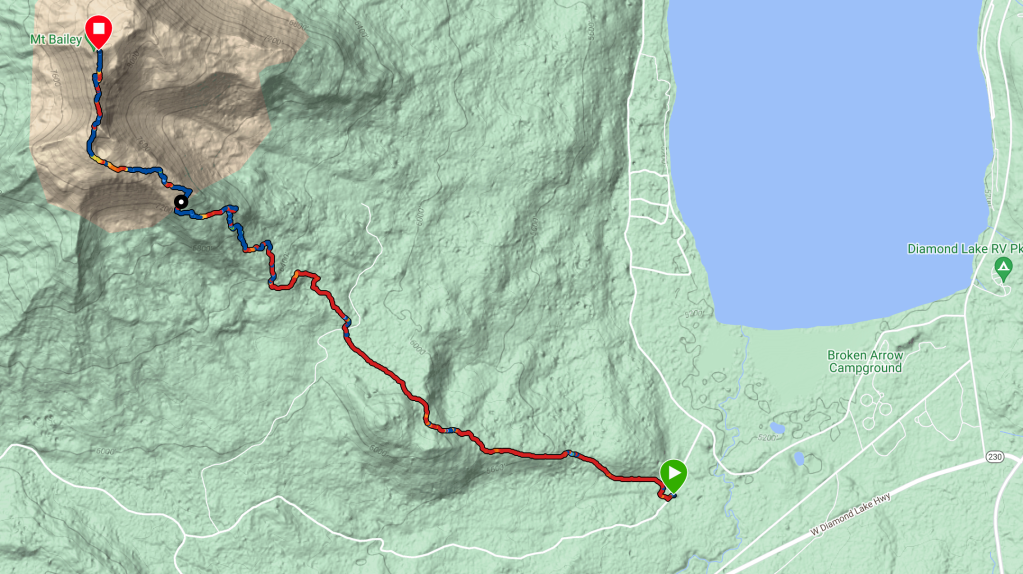
On Friday, July 21, 2023, the first day of the W7O SOTA Campout based at the Broken Arrow Campground at the north end of Diamond Lake, Tyler-ND7Y, Tim-N7KOM, Bill-K7WXW and I woke up early and headed to the Mt. Bailey Trail #1451 trailhead. Tim, Bill and I began our hike there while Tyler decide to see if he could drive his 4×4 Toyota 4Runner up to a secondary access point that cuts off about 2 miles of hiking in each direction.
Tyler made it to the intersection by the time we were just over half way up the first section of trail and began walking down towards us to meet about 500 yards from the road crossing.
The first couple of miles gain about 800ft of elevation, then the real climb starts, with a gain of another 2300ft over then next 3 miles. The trail is mostly in excellent shape, with a few short sections of steep, loose rocky, silt until you climb about tree line around the 4 mile mark. The surface becomes more rock and pumice but is very navigable with my trekking poles.

Upon reaching the crater you are treated to a fantastic view of the surrounding landscape, Mt Thielsen (W7O/CS-002) to the East, Mt Scott (W7O/CS-003) to the South East, Garwood Butte (W7o/CS-036) to the South West and Sherwood Butte (W7O/CS-039) to the South. The trail gets a little more challenging here on out, with very loose pumice, sand and rocks. There is a very short section of more technical trail after descending the false summit where the trail traverses the SE side of the summit ridge. This was the only place I felt a bit nervous as a wrong foot placement could result in a fall down a very steep slope. I made a very conscious effort to double check every foot hold for security and ensured that my trekking poles where solidly planted.
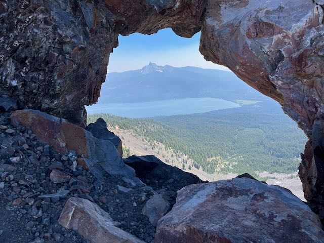
Mt Thielsen viewed through a natural viewport on the technical section
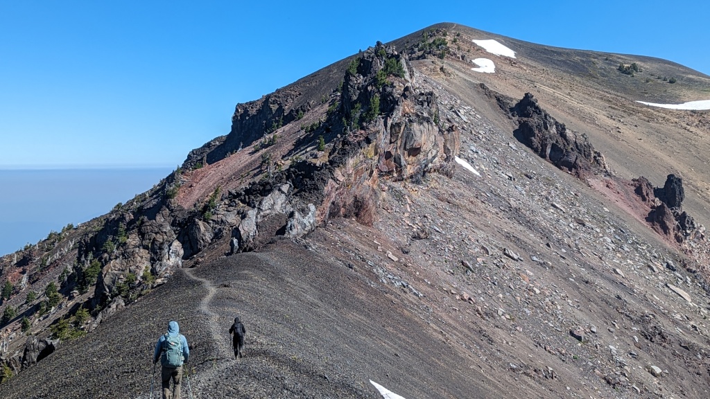
Descending from the false summit
The last bit of difficulty on this section requires one to hoist yourself up a notch in the rocks onto the trail section above. While it wasn’t a bit ledge, it did require me to remove one pole strap and hand both poles on one arm in order to maneuver through the gap. Just about the gap there is a short loose section of switchback before you are on the final .25 mile walk up the summit ridge.
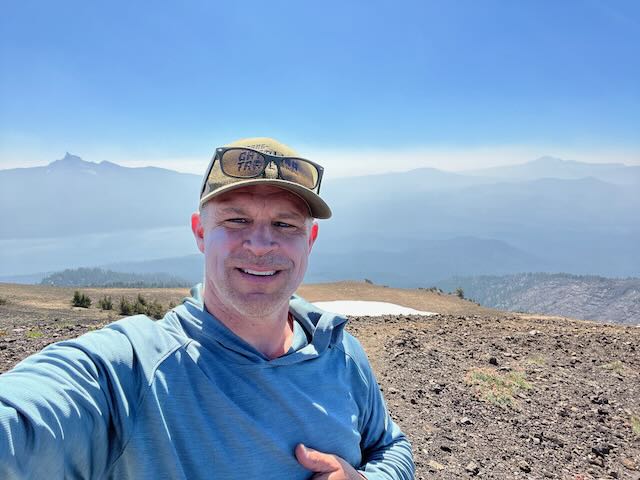
On Top of Mt Bailey, all covered with haze
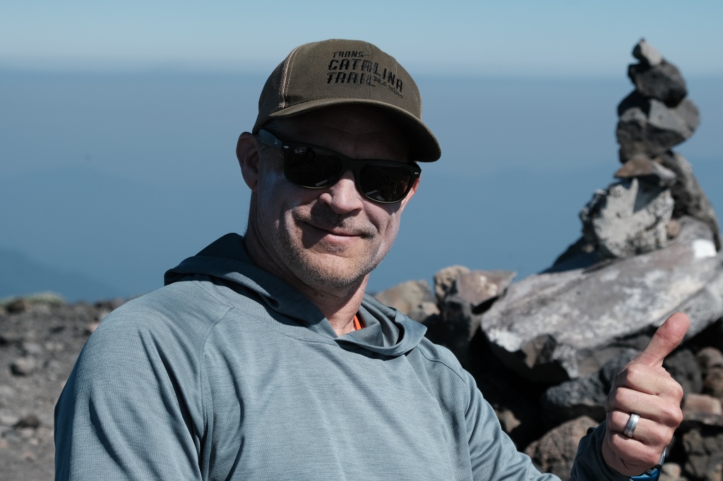
The summit has a large cairn and plenty of space for the four of us to operate. After a short break and a snack, we all worked 2M S2S for 15 minutes, trading off as we each worked various operators participating in the campout. Tim setup his KX2 and he, Bill and I took turns working 20M and 40M CW. Tim had the best luck with 8 contacts on 20 and 1 on 40. Bill got 4 on 20M and I went last with only 1 20M and 3 40M contacts. Tyler choose not to operate HF, as he’s not a CW op and didn’t want to bother with SSB. All told we made 63 2M QSO’s and 17 HF QSO’s. We spent about 90 minutes on the summit before the “second shift” of Guy-N7UN, James-WA7JNJ, and Ryan-NN7M arrived at the summit. We handed the reins over and began our descent, hoping to get completes with them on our way down. We worked several other ops on summits on our 3 mile descent to the road crossing, where we collectively decided that Tyler’s could be our Uber driver back to the trucks at the trailhead. He definitely earned a 5 Star rating when he handed out cold beverages and cranked up the A/C while he expertly navigated the rough road.
Mt. Bailey is a 5 mile, 3600 ft ascent with a few tricky sections to test your hiking mettle. There are two access points, one is easily reached via any passenger car, the other would require a high clearance vehicle and possibly all wheel/4 wheel drive. Its a beautiful hike, but can be hot and buggy so bring plenty of food/water and bug spray (Ben’s 30% DEET worked well for us). I would consider this an intermediate hike due to the elevation gain and some of the exposure, but bringing a new/young hiker along is reasonable with the proper support.