N7OLE and I had to fly down to the area to attend a Memorial Service for Randi’s uncle and now SK Marvin, KL1YY. After flying into Las Vegas and renting a car, we drove to Boulder City for a night in the Historic Boulder City Dam Hotel. We packed light for the cheap flight but managed to fit in our hiking stuff and KX2 with plans to activate at least one AZ Summit while here for the long weekend.
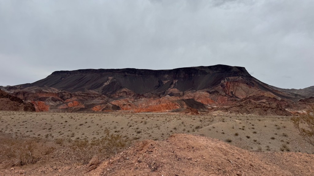
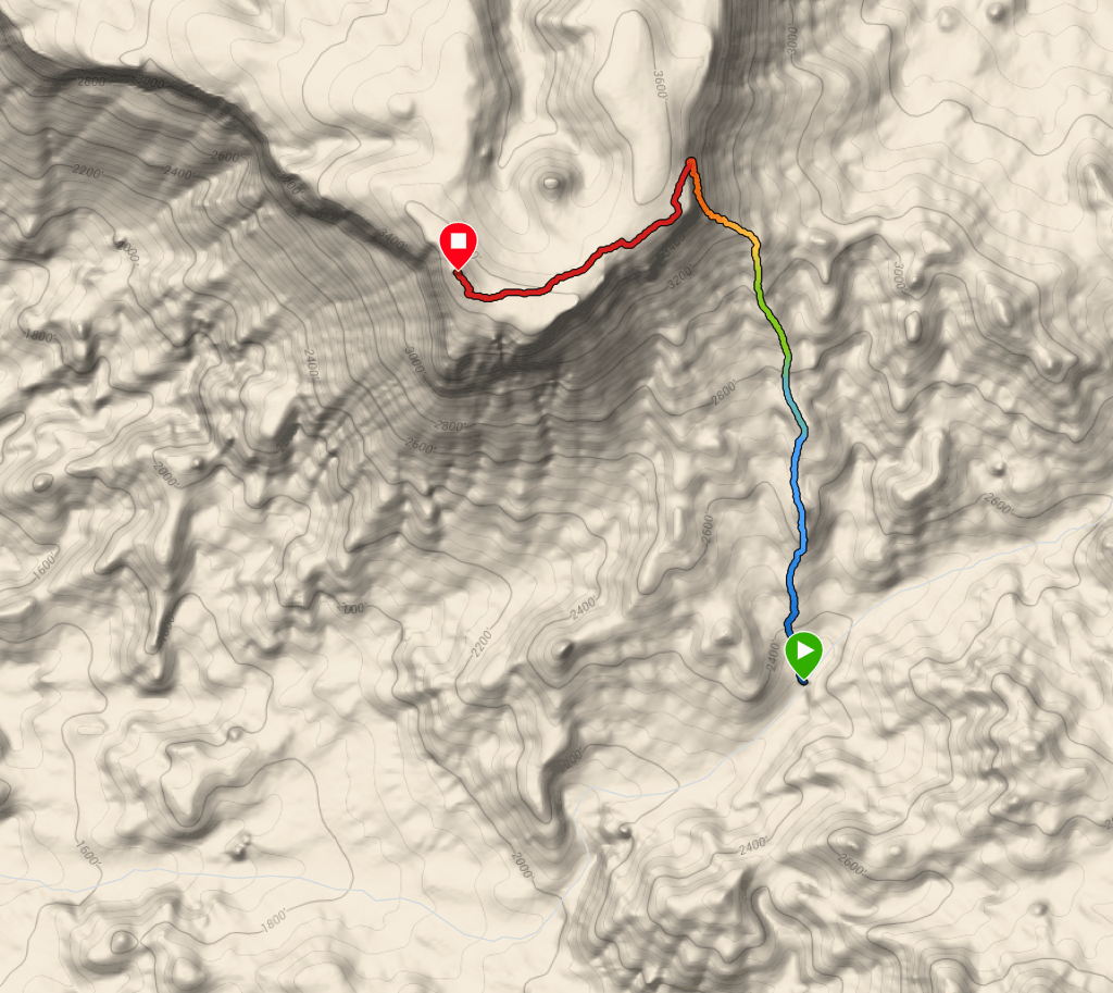
Fortification Hill is a 4 point, 3700 ft rocky topped, plateau, accessible via the Kingman Wash Access Road in the Lake Mead National Recreational Area. The road is well graded with plenty of embedded rocks. The last 2 miles up the wash was recently graded for about 3/4 mile up, after which it is soft but passable in our Nissan Rogue AWD rental. The trailhead is just a single flexible sign at a wide spot in the road but is pretty obvious.
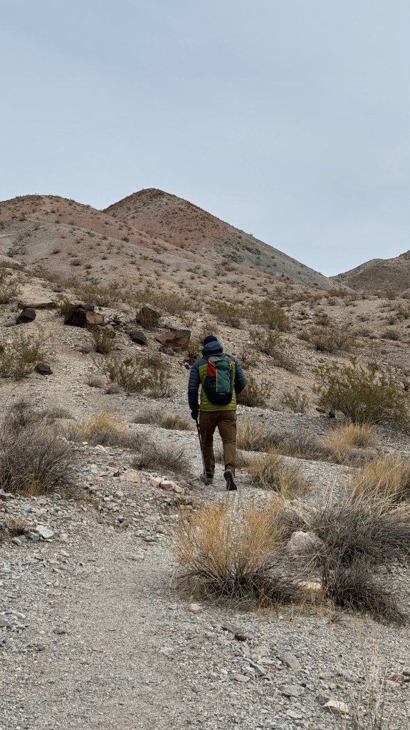

The first mile up is challenging but very doable. 1300 of the 1400 feet of climbing is in the first mile. The trail is easy to follow single track with cairn markers in the less obvious spots. The last .8 miles is flat and easy. The scramble section is quite short and easy if you have decent fitness.
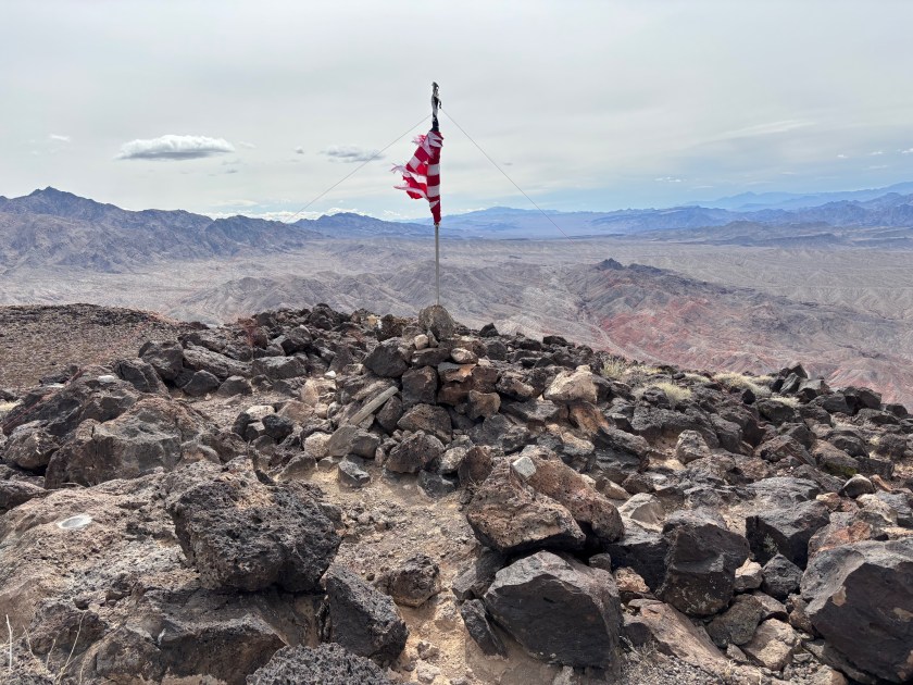
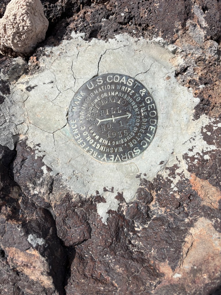
The summit is a 360 view of the surrounding desert mountains to the East and Lake Mead and the Hoover Dam to the West and Southwest. As previously reported, there is an ammo box log book and a flag on a pole.
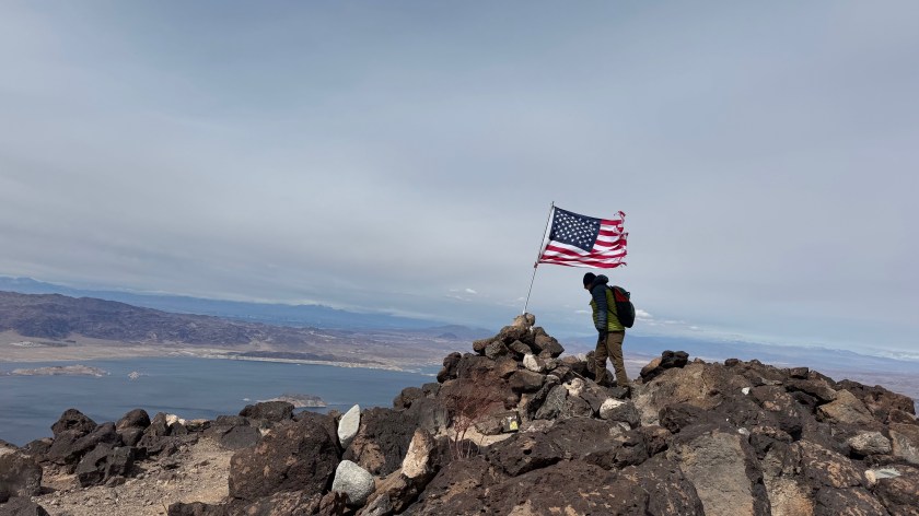
The wind dost blow up there. The flag was full and we were able to attach our antenna to the top of the flag pole though because I forgot the mast at home. We found a nice flat, sheltered operating area to work from and logged 12 QSO’s within 30 minutes. The ambient temp was 50 degrees but the wind chill was no joke. I wore a puffy jacket and with a long sleeved merino wool shirt, a fleece cap and fingerless gloves… just a caution to be prepared even when the weather sites say its 50 degrees.


Leave a comment