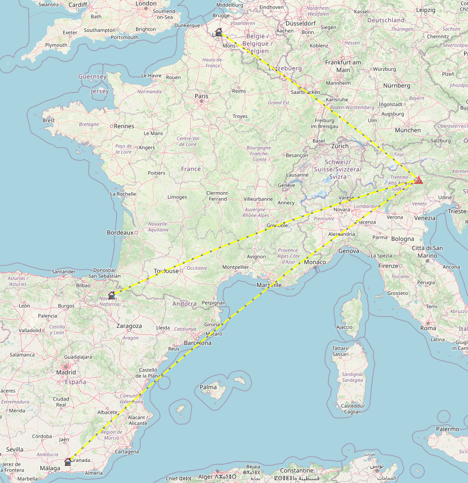
N7OLE wanted me to plan an international trip for her birthday. We looked at several options including Norway, Scotland and Switzerland but ultimately settled on the Italian Dolomites. The original idea was to do a hut to hut hiking trip but after some investigation I decided it would be less stressful to base ourselves from an apartment or hotel and do day trips so we didn’t have to worry about finding our next nights accommodations .
After some more research into where best to base ourselves such that we could do try via ferrata, ride mountain bikes and of course, Summits on the Air hikes we chose to base ourselves near Cortina D’Ampezzo, a resort town that hosted the 1956 and will host the 2026 Winter Olympics.
There are ample places to stay in the area ranging from full houses to studio apartments to hotels. Since we had rented a car, we chose to stay in San Vito di Cadore, a small village ~ 9 km to the South of Cortina at the Albergo Dolomiti. The room was very nice, small and sparsely appointed but did come with a very delicious breakfast every morning. The view from the balcony was worth every penny.
An old train line converted to cycling/walking path passed just behind the building making for a very convenient and safe way to get into the village for food, groceries and shopping.
We flew into Venice and picked up our MG rental car then drove to San Vito after a long overnight flight. Italy being 9 hours ahead of our home time zone, we were ready to grab some food and a long nights sleep to burn off the jet lag.
Tofana di Mezzo and Sasso di Stria :
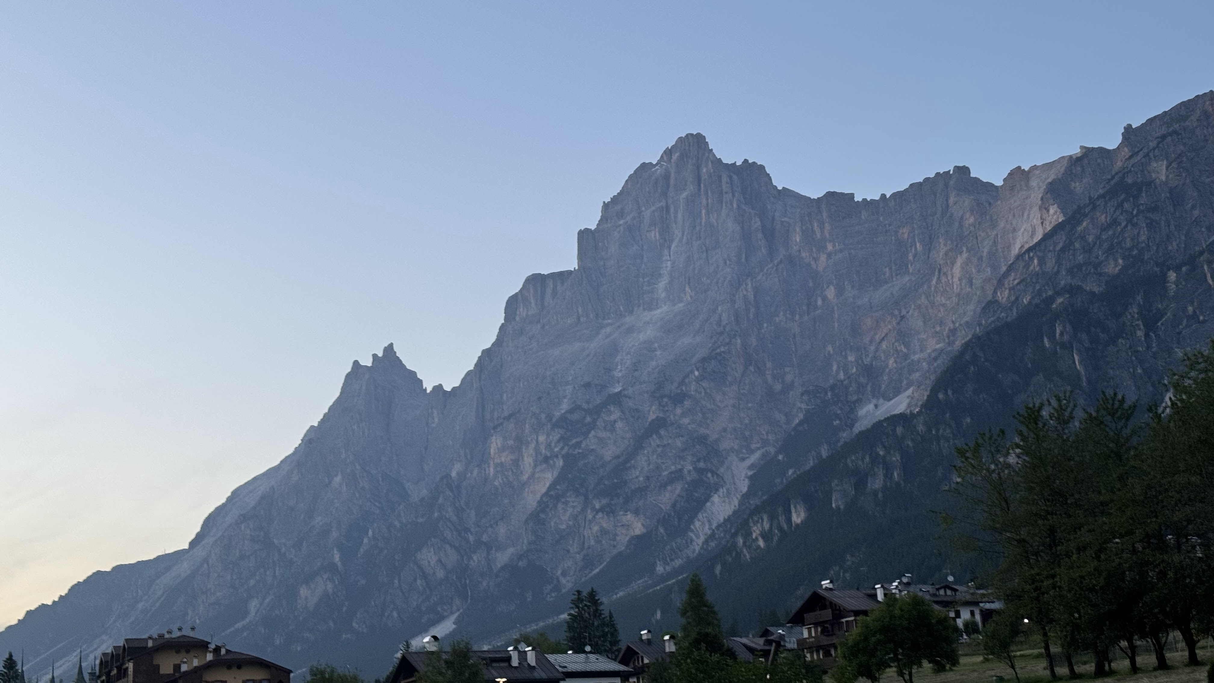
After a long and restful sleep, we decided to jump right into SOTA activities. Tofana di Mezzo, I/VE-002, is the highest of 3 peaks in the Tofana group. It can be accessed via cable car or via a 7 hour long hike, we chose the cable car. Unfortunately, when we arrived at the top house, we learned that the trail to the true summit was closed due to snow in the col between the peak and the top house. We debated jumping the rope, a suggestion planted by the barista “at your own risk” but decided against being “those people”. From this high vantage point, we were able to get a great view of several of the other summits we had on the roster for the week.
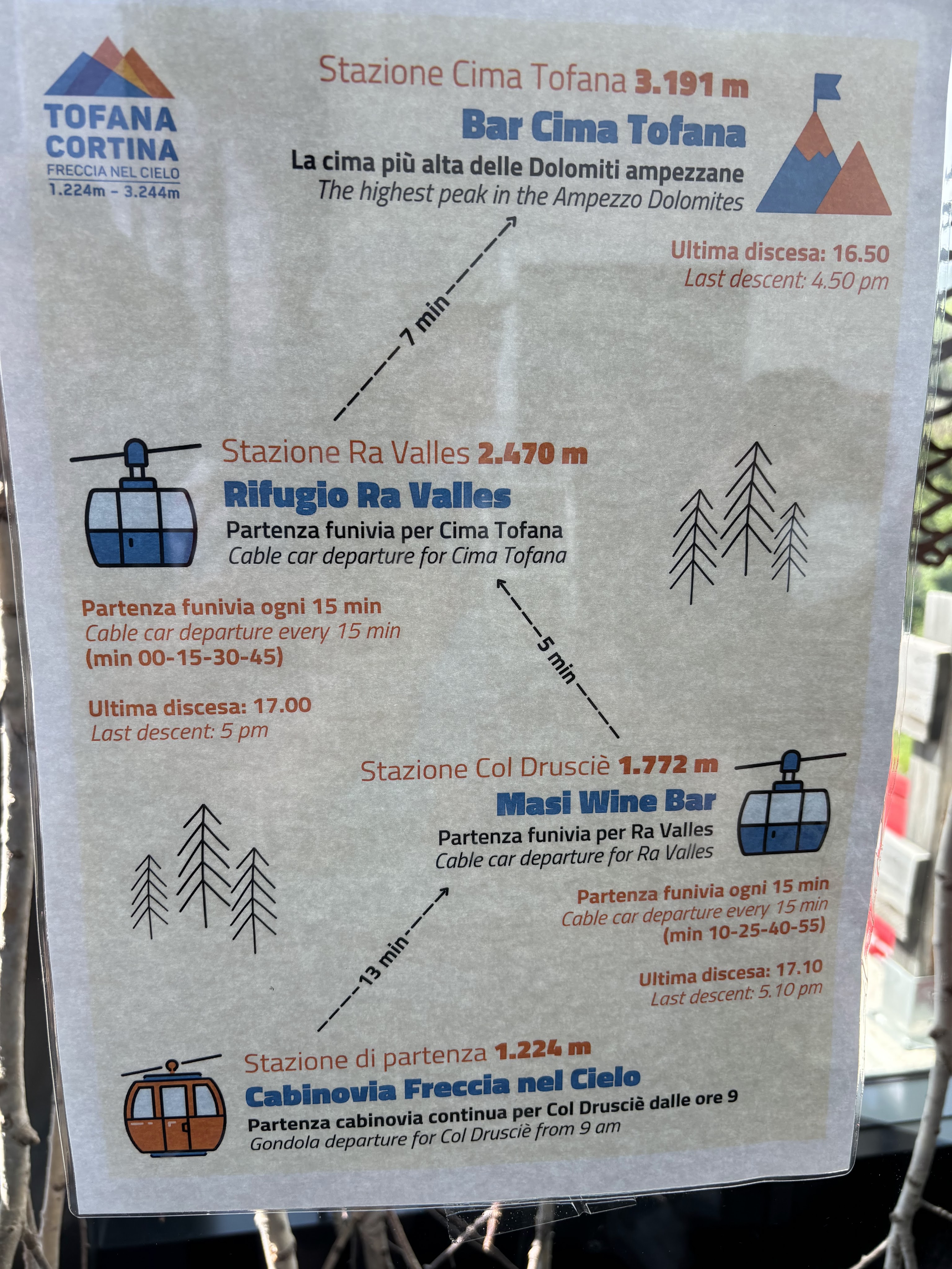
After doing some sightseeing at the stops along the way down, we had some lunch at the first of many Rifugios that we end up visiting during our trip, Rifugio Ra Valles. After lunch we took the tram back to the bottom and broke out Sota Goat to see if we could salvage the day with another summit. We discovered that Sasso di Stria was not too far away and had a relatively short approach hike, so we headed up Passo Falzarego in the rental.
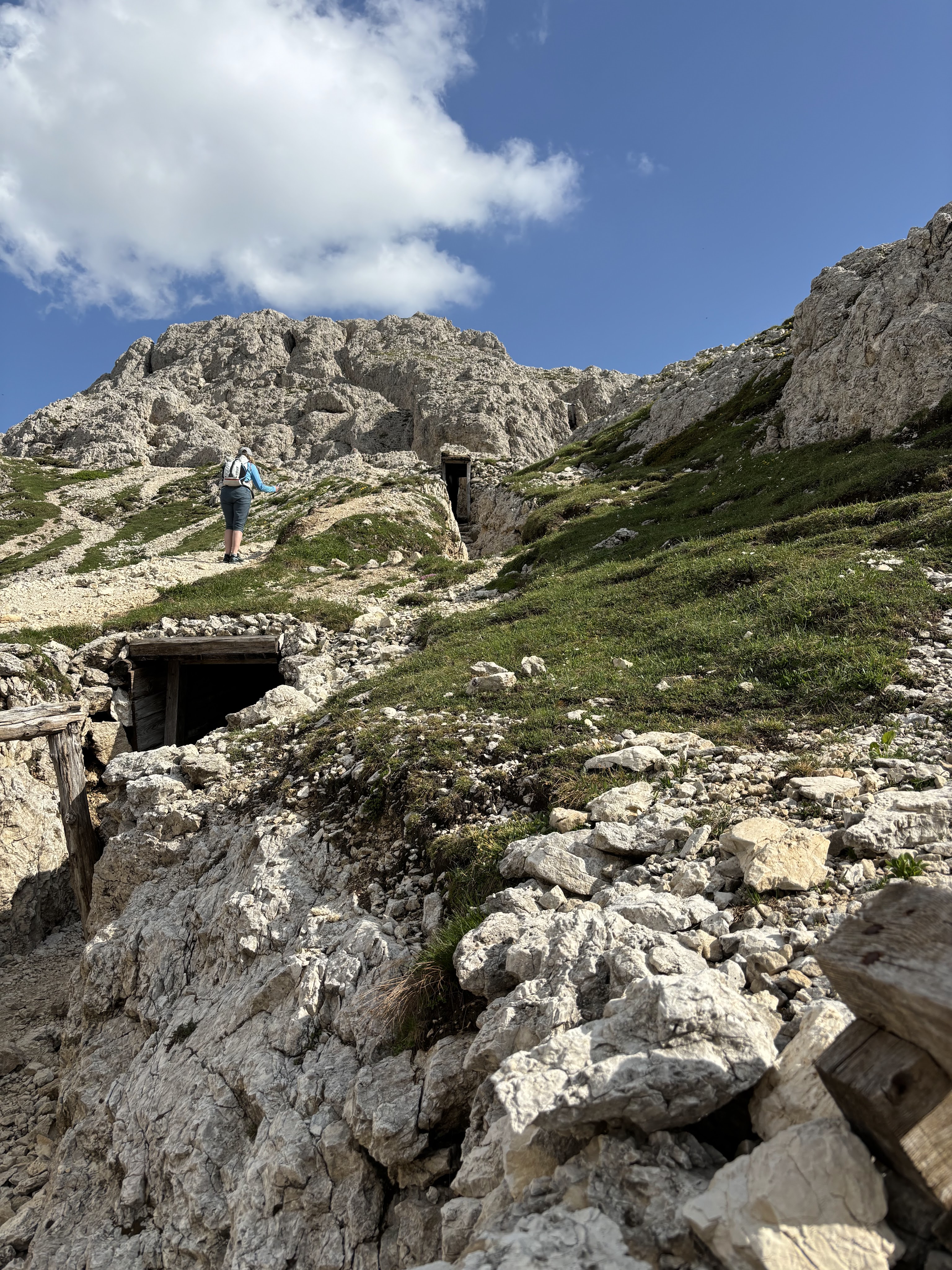
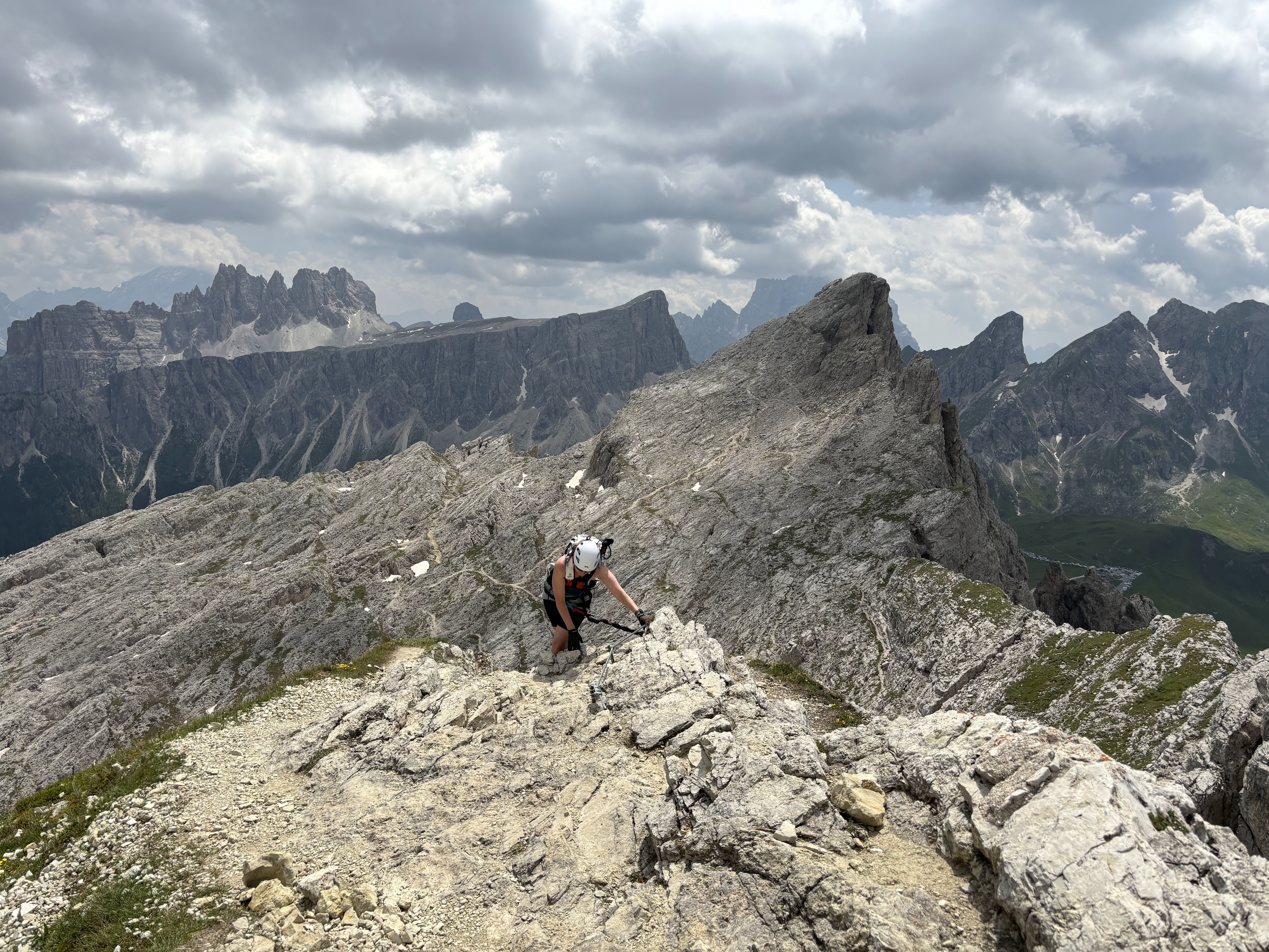
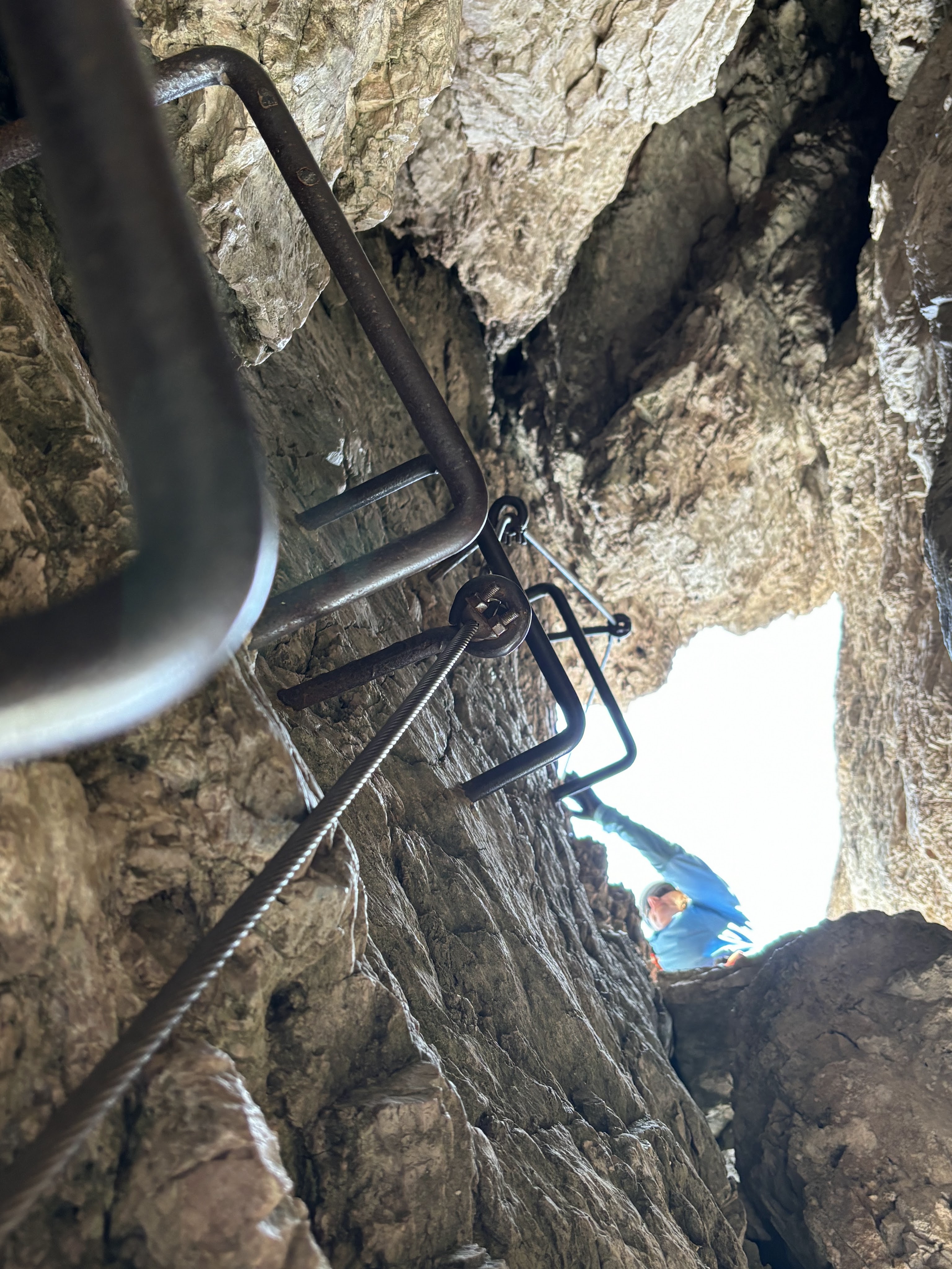
The hike was pretty straight forward, unfortunately I didn’t start my watch until mid way up and it didn’t capture a clean track. It was ~ 1.7KM with about 200 M elevation gain. The trail follows some World War 1 trenches, some of which you can walk through. There are a few ladders and a short cable assisted section of the path. A group of rock climbers ascending the NE wall of the mountain were perched at the top when we arrived so we moved away from the cross and setup the EFHW antenna on the fishing pole mast.
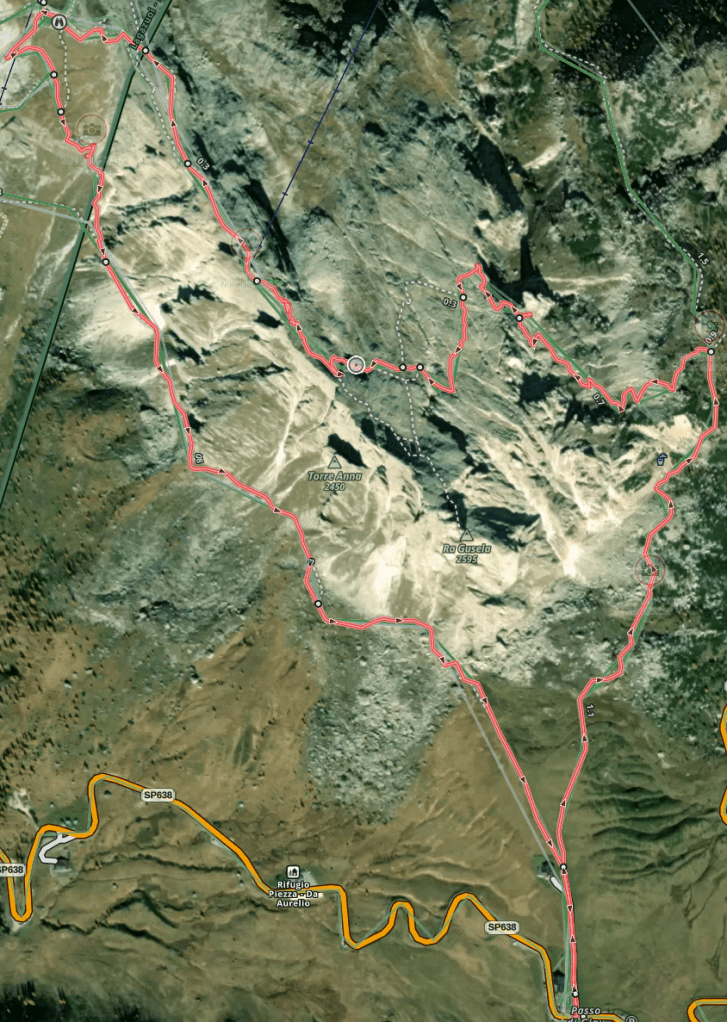
Via Ferrata Ru Gusela to Nuvolau – I/VE-053
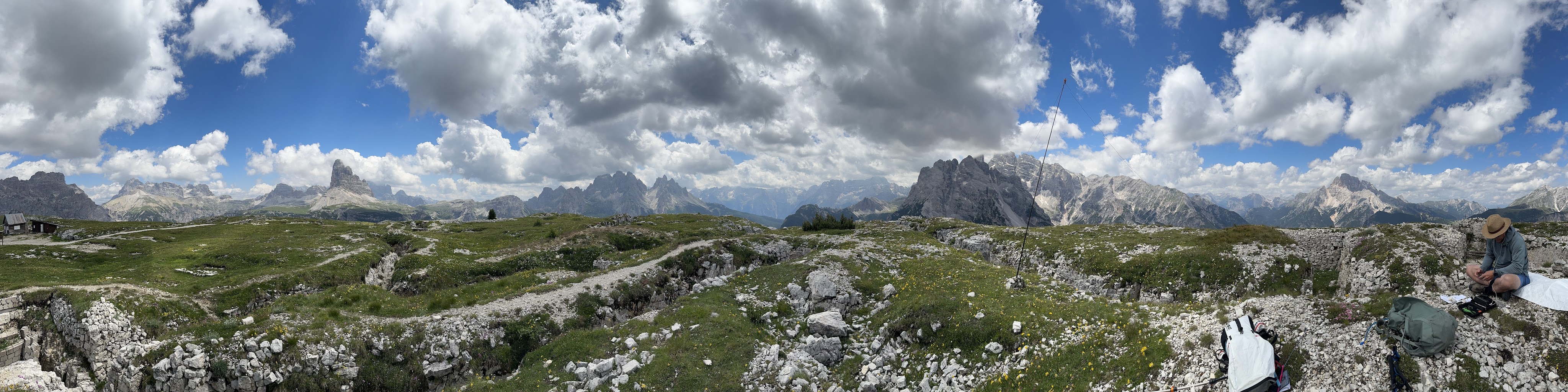
During my research into the area, I discovered the proliferance of via Ferrata, “iron route”, in the area of Cortina. Many of the routes lead to or terminate on SOTA summits, two of which I had on our itinerary. Ra Gusela takes climbers up to the top of Nuvolau, a 10 point summit with a nice rifugio on the top. The route is pretty easy but we chose to get the appropriate gear, though we saw many hikers going without protection. It took us about 90 minutes to climb the route from the parking area. Upon reaching the summit we decided to get the activation done before getting beers and burgers at the Rifugio.
We made quick work of the activation with a couple of 2M S2S and a few SSB contacts. We were hungry and ready for some food.
After lunch we descended the primary hiking route down to Rifugio Averau. We had planned to summit Averau via another ferrata route that afternoon, but thunderstorms were rolling in and after climbing up to the first cable protected section to get a glimpse of what we had to ascend, we made the decision to come back another day. This turned out to be solid decision as it started to rain and thunder about 30 minutes later. The hike back down to the Passo Giau and our rental car required we deploy all our rain gear.
Averau via Ferrata – I/VE-045
After a busy first couple of days, we decided to do an easy summit that involved a shuttle bus ride up Monte Rite, the location of one of the Reinhold Messner Mountain Museums. Unfortunately thunderstorms rolled in just as we got the mast in place and we had to tear down and run to the museum for shelter. We tried to wait out the storms but after 90 minutes we decided to catch the next shuttle back down and try again another day.
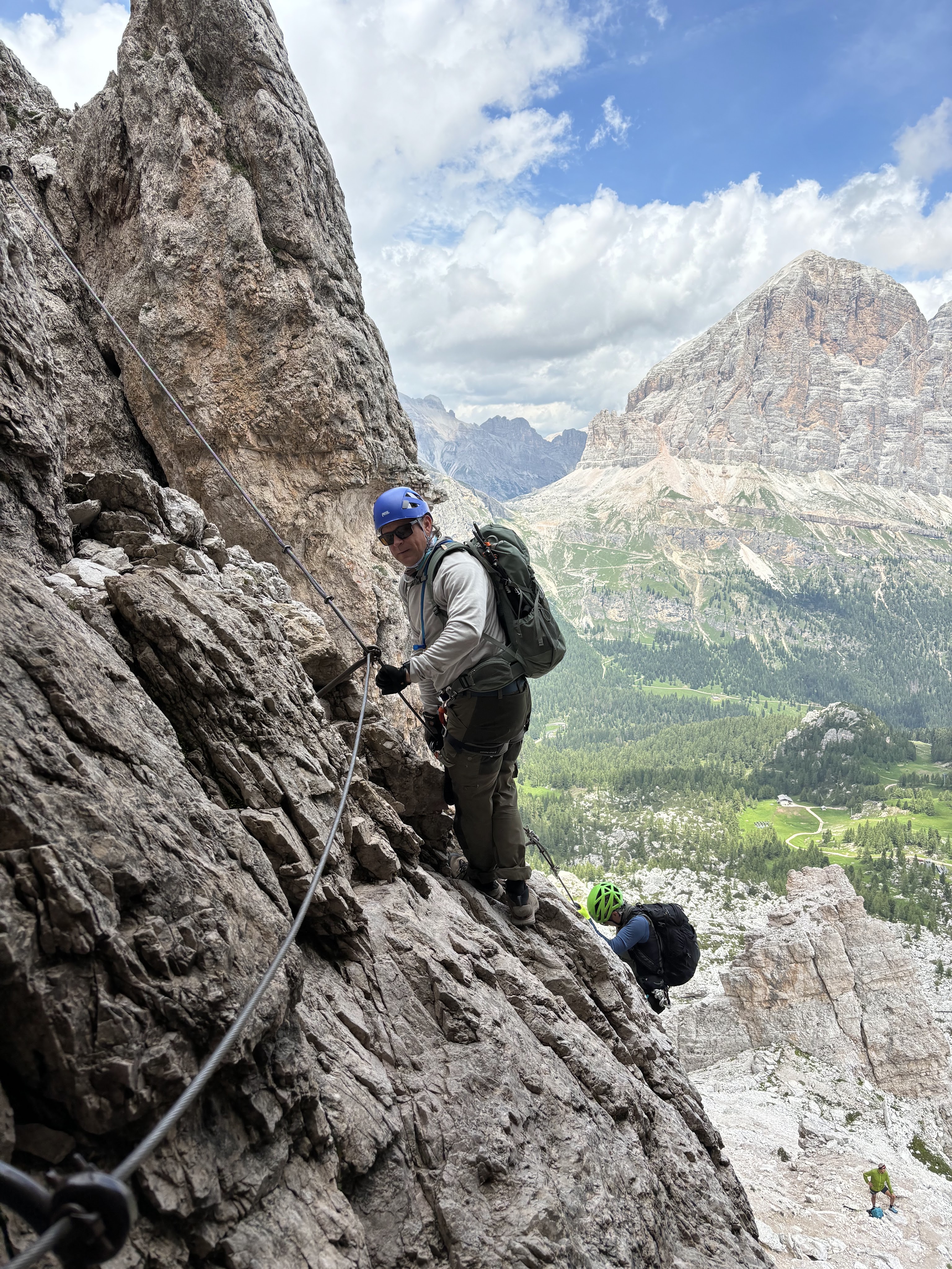
The next morning we returned to Passo Falzerego and boarded the chairlift to take us up to Rifugio Scoiattoli, where we began our walk up to the Rifugio Averau via the service road, then on to the trail leading to the first cable section of the route. After waiting for a descending group to clear off the cables, we hooked in and began our climb. This ferrata was a bit more technical than the first, with a much longer cable protected section. However, once at the top of the cables, the climb was relatively easy.
Once on top, we added our names to the summit log, then found a nice spot to activate a few meters away from the summit cross in order to not impede on others experience. While this climb is a bit more technical than Ra Gusela, it is a lot more popular. We had to wait several times on the descent for other climbers to clear the cables.
We worked a couple S2S on 2M then setup the KX2 and collected the remaining contacts we needed on 20M & 40M SSB. As seems to be the pattern in the Dolomites, afternoon thunderstorms began to build so we packed up and headed down after about 40 minutes. The descent was a fun challenge on the cables. There is so much traffic that there is an alternate descent route that veers off the main cable section and took us down a rock chimney on ladder rungs.
After leaving the cables we walked back down to the Rifugio Scoiattoli for an upscale lunch and a walk around the ruins of a nearby WW1 fortress.
Monte Piana I/VE-112
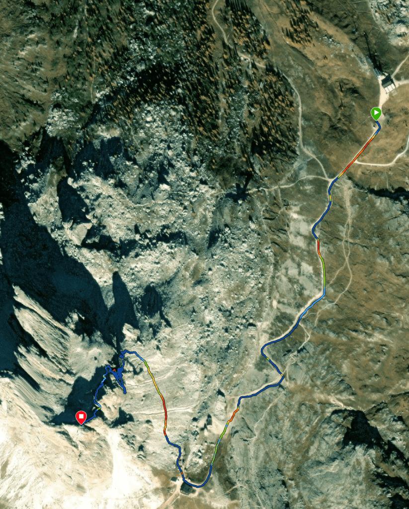
At the end of the previous day I noticed a slight tingle in my throat and I began to develop a light cough. I had noticed a lot of other people coughing and sneezing and I was hopeful that it would pass with a good nights sleep. Unfortunately, I coughed all night and by the morning I was sniffling and sneezing. It seems like every time I travel long distance on airliners I have ended up with some kind of illness, ce la vie. We hit up the local pharmacy and fortunately I bought Sudafed and allergy medicine just in case. I felt well enough to get out of the hotel but didn’t want to do a difficult hike as I was pretty tired so we drove out to Misurina and took the Jeep shuttle to the Rifugio at the top of Monte Piana. After a short 1.1KM walk, we reached the high point and setup the KX2 and K6ARK End fed random wire on the mast on a hummock of earth surrounded by WW1 trenches.
We made a few S2S contacts, N7OLE doing most of the activation on 2M whilst I operated HF. Conditions were a bit rough but I was able to grab my first CW contacts of the trip. I wasn’t confident I could copy European callsigns so I chases S2S only. Since we didn’t have a long hike or any pressing plans, we were able to operate for a couple of hours. When the contacts dried up we packed up and walked around to see more of the WW1 ruins riddled across the mountain top.
Monte Tranego I/VE-188 and Col de la Crosse I/VE-177
All the places we had visited thus far are very popular and we were looking for something less travelled. N7OLE noticed these two summits were pretty close together and Rifugio Antelao was on the route so we could get some lunch and beverages while we were out.
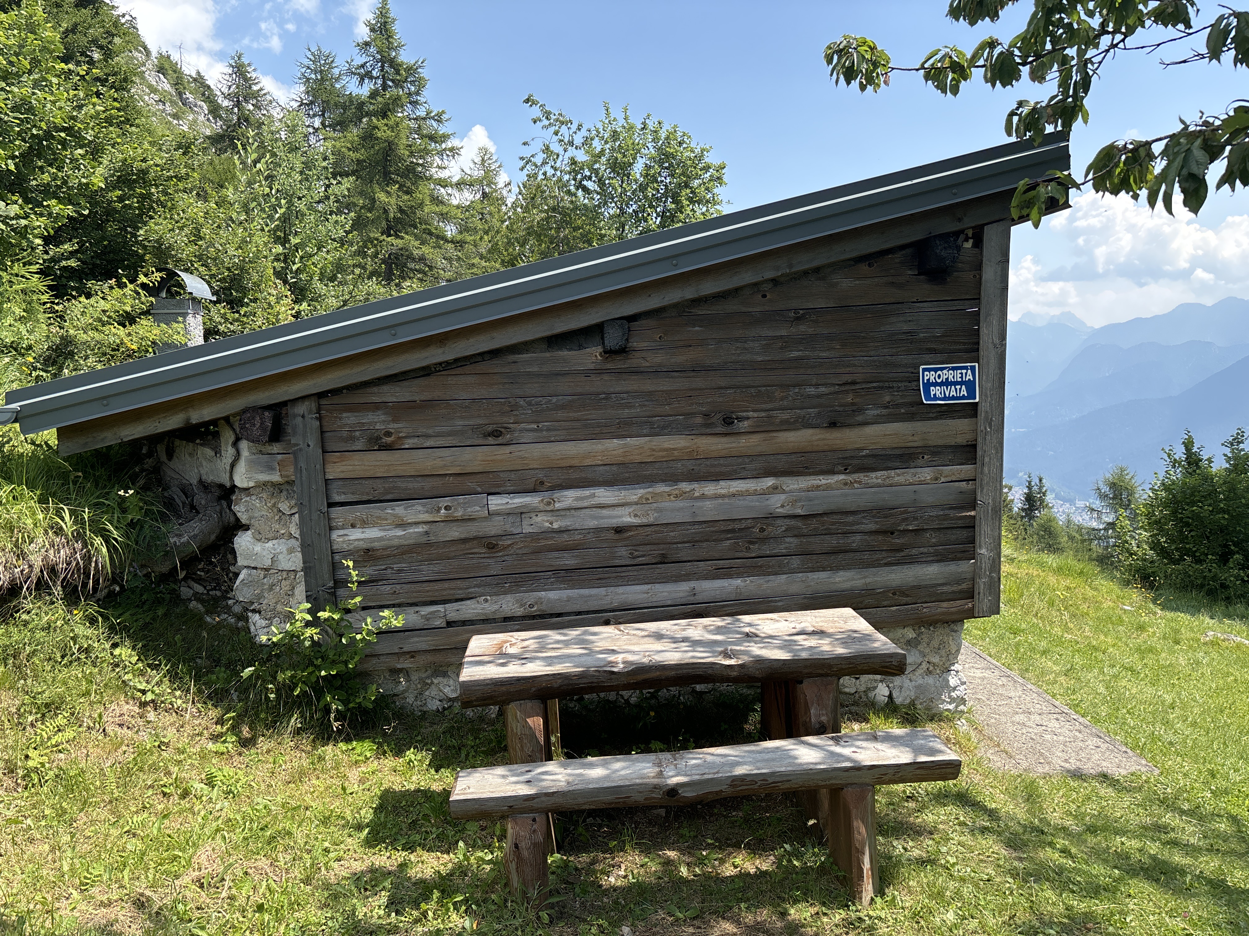
We drove to the trailhead just above the town of Pieve de Cadore to begin the hike. The first portion of the walk is all business, climbing 600M in 3KM. Later I looked at another mapping app and noticed we hiked up a downhill only mountain bike trail, which explained a lot about the steepness of the route. There is a nice private cabin about half way up with a picnic table for a short rest.

Leave a comment